|
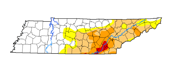
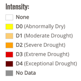
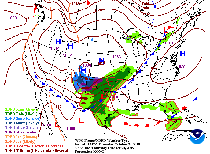
Good afternoon to everyone! We will have one more beautiful day before showers move in Friday and the weekend. Before I touch on that, take a look at the latest drought monitor map for Tennessee. VERY dry conditions still present in Bradley, Hamilton, and Rhea counties along with much of east TN. Luckily, rainfall will be moving in tomorrow and this weekend, helping combat the dry conditions. Looking at the current surface map, you can see a cold front beginning to work in from the west. This will arrive tomorrow, cooling temperatures down to a high in the lower 60's. Along with this front, expect showers to move in by tomorrow afternoon. As you can see from the latest model guidance, light showers will move in tomorrow afternoon and become more moderate tomorrow night. These will carry through the day on and off Saturday before slowly moving out the later half of Sunday. Overall rain totals are around the one inch mark with higher totals expected in middle Tennessee. The bulk of rain will ride middle to West TN and push north. Rain totals in these areas could exceed 2 to 2.5 inches through the weekend. As unfortunate as it is to have a wet and gloomy weekend, we are in need of rainfall as you can see from the drought map. Much cooler temperatures are in the forecast for next week, so stay tuned as we will discuss this in more detail tomorrow. Remember your umbrellas out of the door in the morning, as you will likely encounter rain on your way home from work tomorrow afternoon.
0 Comments
Leave a Reply. |
Your trusted source for everything weather in East Tennessee.
Social Media
|


