|
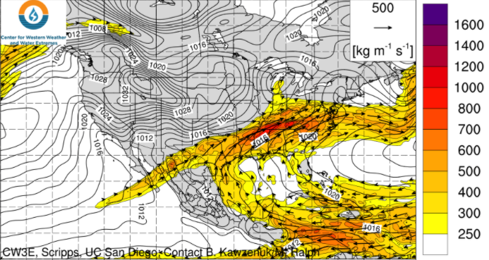
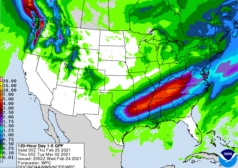
Any rain we had this morning has shifted east and out of the area. Cloud cover has worked out as well but will quickly moving back in tonight. Several waves of rain will push through the Mid-Atlantic this weekend and early next week bringing the chance for heavy rains and flooding. The graphic below is of integrated water vapor transport. This is essentially where the water vapor (for rain) will be derived from and by how much. As you can see, dark shades of red indicate heavier water vapor (AKA heavier precipitation amounts) across Tennessee and Kentucky. The Gulf of Mexico will be a direct pipeline for the moisture we see ahead. Trends continue to stay on par with a soaker through the weekend. A low will carry a warm front north providing moderate to heavy rainfall Saturday into Sunday. As the low works north and east, a trailing cold front will bring additional moisture Sunday into Monday. Rain will begin working out with scattered showers not out of the question through midweek. The Weather Prediction Center has rainfall totals through Monday night in the ballpark of 4-7 inches. This will be a significant amount of rainfall over a 4 day period, so anticipate water build up. The axes of heavy precipitation is still in question so continue checking back in for updates. As of now, 4-7 inches is possible for north central and northeastern Tennessee. The one positive is the abnormally dry conditions much of the state has been dealing with the past several weeks. This could help combat heavy rainfall early, but water build up will be likely in the end. Most locations should see upwards of 3 inches with much higher amounts likely depending on where the higher moisture plume ends up. Continue to stay up to date here and on Twitter/Facebook as we'll provide a better idea on rainfall amounts, impact, and timing Thursday and Friday. Enjoy the day as high's remain above average (around 60) but will be cooler than what we saw Wednesday. Pre-recorded for 5pm show
0 Comments
Leave a Reply. |
Your trusted source for everything weather in East Tennessee.
Social Media
|


