|
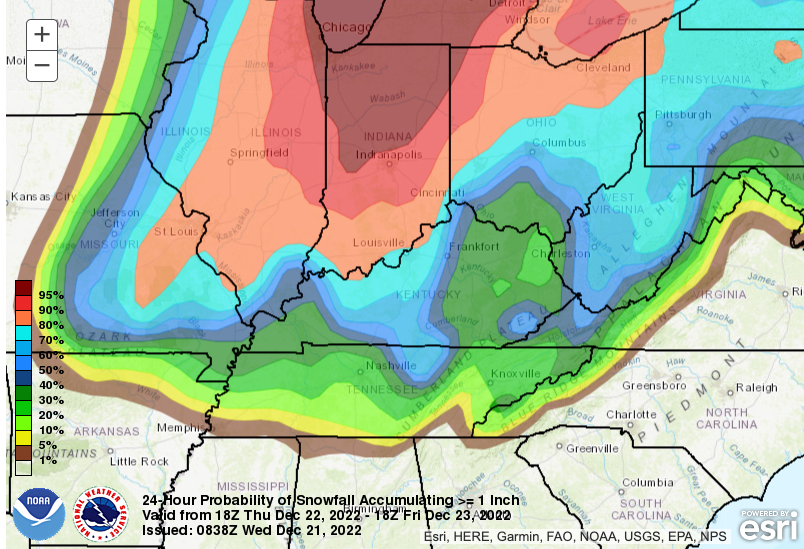
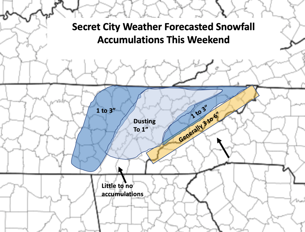
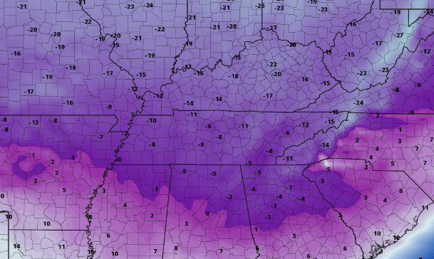
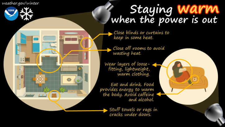
Details about the upcoming wintry system continue to become clearer. Leading up, we will see increasing cloud cover today where highs find the upper 40s and low 50s. A powerful low pressure system and arctic cold front will develop across the Midwest and spin east over the next couple of days. To our south a weak disturbance will bring the chance for a few isolated to scattered showers overnight tonight, with generally drier conditions in for Thursday morning. This won't last long though, as showers ahead of the approaching front increase across the area tomorrow afternoon, evening, and into the night. With the front crossing between midnight and 5am early Friday (from west to east), temperatures will rapidly plummet. Some locations could fall as much as 30 to 40 degrees in as little as 4 to 8 hours. Given this drastic drop off after a wetting rain, icy road conditions are favorable. This will create issues for any travel Friday morning, so begin to plan accordingly now. Looking at the potential for snow accumulations greater than 1 inch, it is not promising. As usual the valley fairs the worst, while the higher elevations (plateau, foothills, Smokies) have the highest probabilities. As mentioned above, snow is likely with this system. Though amounts vary and there is still some uncertainty involved, they will generally be light for most. The bulk of the valley can generally expect a light dusting to up to an inch. The central valley and south will fair the worst, with snow showers likely for a brief time but little to no accumulations. Outside of here, the Plateau will vary from a few tenths up to 3" and likewise for the Foothills. Keep in mind higher resolution data is beginning to get ingested, so changes will be possible with the snowfall forecast below. Some models depict higher totals than what we have forecast, but I feel warm ground conditions initially, as well as the quick progression of the system will really eat into accumulation chances. Nonetheless, we will continue to monitor trends and provide our latest thoughts. Our third big hazard, outside of light snowfall and icy conditions, will be dangerously cold wind chill values. This will be particularly so Friday and into Saturday morning. With highs only in the single digits and teens Friday (more on this in our video below) and winds out of the west between 15 and 25 mph (gusts 30 to 40), wind chills readings of sub-zero will be common. Some could feel as cold as -20 to -25, which has warranted a Wind Chill Watch from the NWS in Morristown. This will likely become a warning for most by this time tomorrow, so stay abreast to the latest alerts as they come. Lastly, with extremely cold and blustery winds, power outages are likely for some. With fair conditions today, take action now by planning for the worst and knowing what to do is power outages strike. Here is an info graphic below highlighting some of these actions. That will wrap it up for today. We will continue to provide updates via Twitter & Facebook, so be sure to give us a follow @SecretCityWx Another update regarding this system will come tomorrow, likely in the form of a full video briefing, so stay tuned. Plan now for the upcoming cold, address any travel changes that may be needed, and have an action plan if power outages do occur. Pre-recorded for 5pm weather broadcast
0 Comments
Leave a Reply. |
Your trusted source for everything weather in East Tennessee.
Social Media
|


