|
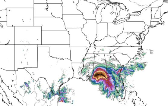
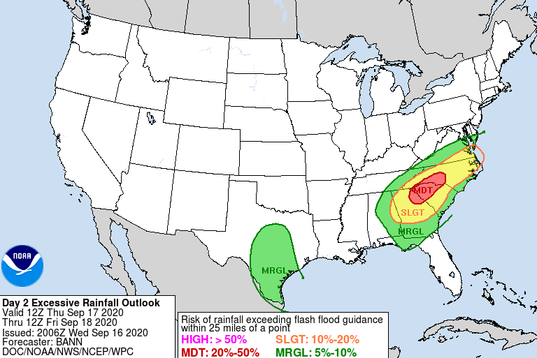
Good morning! The latest 24-hour precipitation analysis shows the life-threatening rainfall for parts of Florida and Alabama. Due to the nature of this storm as its slow movement before landfall, some parts of this region picked up 10+ inches of rainfall in a 24 hour period. As what is left of Sally works north and mainly east, heavy rainfall will continue as depicted by the WPC excessive rainfall outlook below. A marginal risk for flash flooding covers most of east Tennessee today, so look out for those in flood prone areas. I still believe most of the activity will hang to counties far south and east throughout today. Specifically, counties like Polk up to Cocke will likely see the highest rainfall amounts before the day is over with. The good news is once Sally moves out tomorrow morning, we'll start to see some clearing taking place. A front to the west will force Sally eastward bringing drier and cooler air behind it. Showers will end early Friday, leaving the remainder of the day cloudy and cool. For Saturday, we will gradually clear out with sunshine returning by the afternoon and through Sunday and early next week. Comfortable to cool temperatures will also accompany with high's in the mid 70's and overnight low's in the low to mid 50's. A fall-feel is definitely upon us, so take advantage of the overall beautiful weekend we are expecting. For more insight on the weather in east Tennessee, check out our daily video below or email us at [email protected] for more information. We'll see a mix of showers throughout today before gradually clearing Friday and early Saturday.
0 Comments
Leave a Reply. |
Your trusted source for everything weather in East Tennessee.
Social Media
|


