|
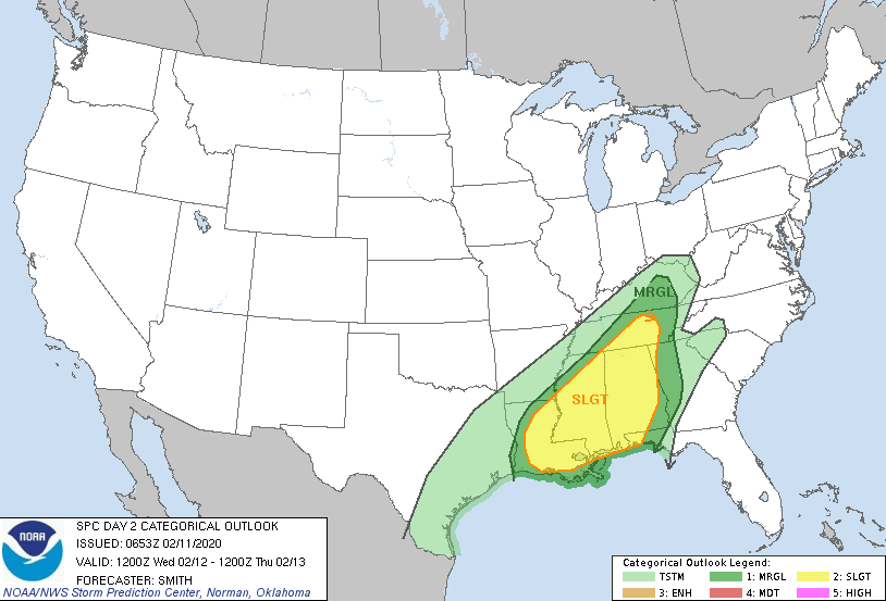
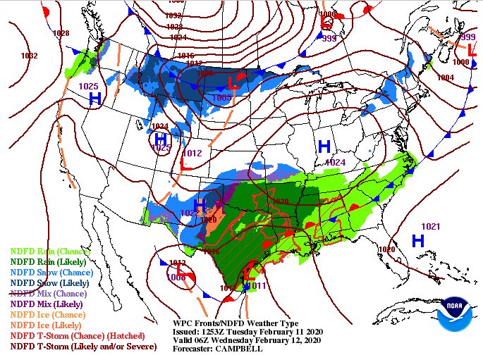
Good afternoon! I have some good news for today as we'll stay mostly dry through the afternoon and overnight hours. As we work into Wednesday, showers work back in. The outlook from the SPC remains much of the same with a slight risk for the Plateau and middle TN and marginal risk for east TN. The main threat will be damaging winds but isolated spin up is possible as well. With the heavy rains we have received the past few days, be weary of trees overturning in strong wind situations. Lots of rain has contributed to loose soil and, in some cases, mudslides. Looking ahead, we will stay mostly cloudy this afternoon and overnight before scattered showers arrive tomorrow morning. Strong to severe storms will move through in the evening and overnight hours ahead of a cold front. Once this front moves through, expect clearing to take place and temperatures to drop throughout the day Thursday. Friday and Saturday look to be beautiful with sunny skies overhead. Looking at model guidance, the last of the showers are moving through the Smokies now. This will leave the remainder of today with mostly cloudy skies and mild temperatures. Scattered showers are expected to arrive Wednesday morning and continue into the afternoon. By the evening and overnight hours, a heavy line of showers and storms (strong to severe) will work in. As we get into Thursday morning, shower chances decrease and a cold front will slide through. With the cold front, expect clearing to take place overhead and temperatures to fall throughout the day. That will set up a sunny end to the work week on Friday with temperatures around 40 degrees for the high. Enjoy a break from the showers this afternoon because more are on the way for tomorrow. As of noon today we have picked up 2.65" of rainfall and more is on the way for Wednesday. Stay weather aware tomorrow, especially the evening and overnight hours. Lastly, stay up to date with us on Twitter & Facebook for the latest.
0 Comments
Leave a Reply. |
Your trusted source for everything weather in East Tennessee.
Social Media
|


