|
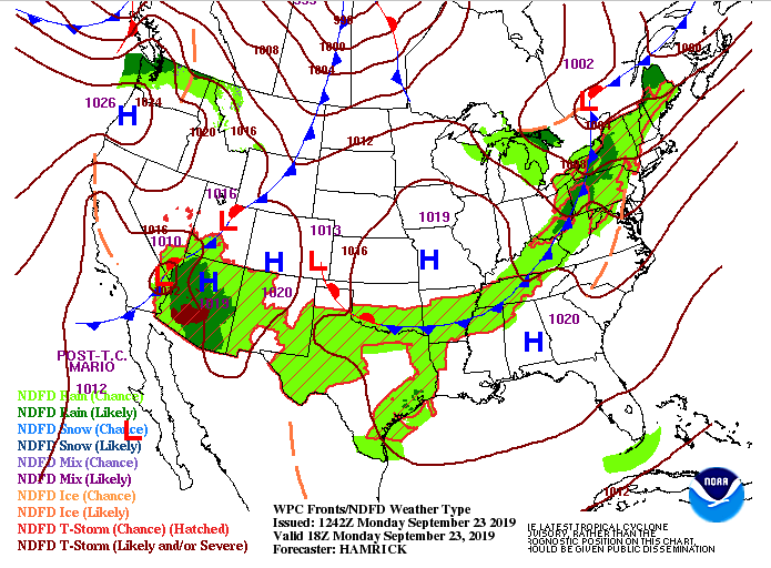
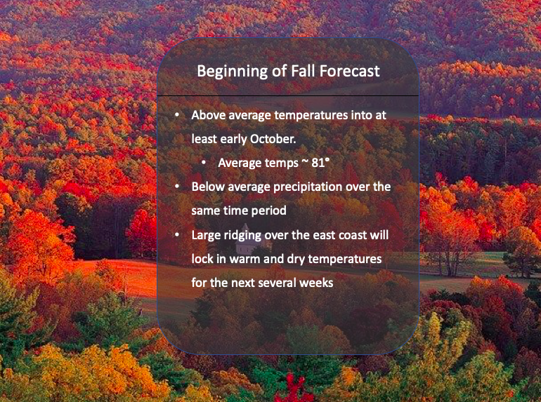
Today is officially the first day of Autumn but its not feeling like it as we are expecting high's in the mid to upper 80's this afternoon. We will cool down a touch for your Tuesday as a weak cold front will slide through this afternoon. This could provide us with some limited shower potential (30% chance) overnight, but these will be light and quick moving. Tuesday and into the later half of the week a high pressure system will slide in locking in warmer temperatures and keeping us rain-free. Looking at our model guidance (below) we see how the drier air aloft will keep rain chances limited tonight. We will definitely be hoping for some much needed rain, but amounts and spread potential (how widespread these showers will be) will both be low. Tuesday we will stay dry with mostly sunny skies and highs in the mid 80's. Taking an extended look into the first month of Fall, we will continue this pattern with dominate ridging being the main story. This will keep in warm temperatures and limited rain potential the next several weeks (into at least the first week of October). Thats all we have on your Monday, I hope everyone has a good day! We will be hoping for some rain showers this evening, followed by cooler and drier air Tuesday.
2 Comments
11/10/2019 19:04:29
It is incredible how hot it is, especially when it is the Fall season already. I am really hating everything that is happening in this world of ours. I want people to go and address the climate change and the global warming that is happening. It is no longer a threat, in fact, it is now a huge thing that we need to take care of. We have to make some changes to our lifestyle if we want to counteract the negative effects of global warming.
Reply
Leave a Reply. |
Your trusted source for everything weather in East Tennessee.
Social Media
|


