|
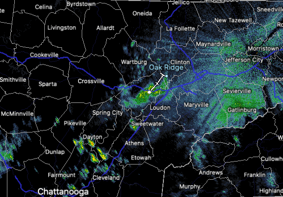
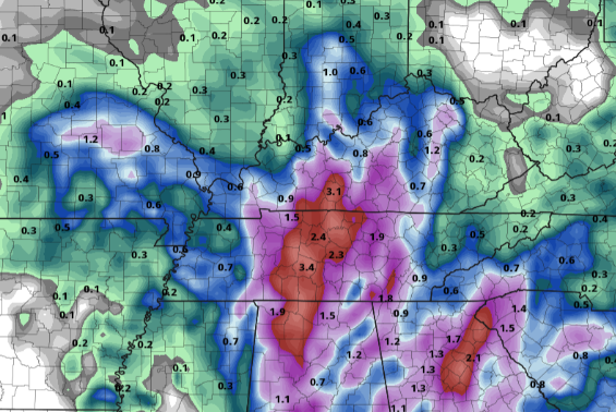
Showers are already developing and moving through this morning for portions of the southern valley and into the central valley. This will continue, becoming more widespread this afternoon and evening, with highs topping out in the mid 70s. As we work ahead, moisture will continue to be pumped into the area. Waves of heavy rainfall will arrive at times, specifically into the day on Wednesday. Activity will continue through Thursday morning, before becoming more scattered. A much better shot at a dry and sunny day returns just in time for the weekend, with Saturday partly to mostly sunny and warm. Looking at this one (of many) models, heavy rainfall can be expected through tomorrow evening. Combining this with the WPC's excessive rainfall outlook, flash flooding will be a large concern through Wednesday. Specifically, the WPC has placed nearly all of the area under a marginal risk, with a slight risk and even a moderate risk along Chattanooga and the border. Be sure to view our video forecast below for more information. Take precautions now for those in low-lying and flood prone areas. Training storms, or storms that continue to dump rainfall over the same area, will be the biggest concern later today and through Wednesday. With a hydro threat hanging around, mainly into the day tomorrow, be sure to follow us on Twitter/Facebook for all the latest information. You can follow us at @SecretCityWx. Have a good one, be safe, and don't forget to send us reports of what you are seeing out there. Pre-recorded for 5pm show
0 Comments
Leave a Reply. |
Your trusted source for everything weather in East Tennessee.
Social Media
|


