|
Good afternoon and what a soggy one it has been so far. Our station (in Oak Ridge) has picked up just shy of half an inch so far today with much more in the forecast this weekend. The latest radar scan can be seen below. Scattered showers will continue on and off through the day and into tonight. 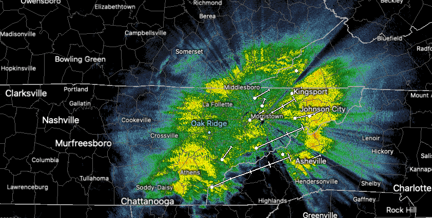 Timestamp: 1:20 pm As waves of moisture work in this weekend, flash flooding is a big concern. Two major rounds of rain break down as follows: Round 1: now through the first half of Saturday, moisture will bring moderate to heavy showers periodically. There will be breaks from the rain at times, but they likely won't last long. By tomorrow afternoon, we take a brief break from showers before round 2 arrives. Round 2: This is the big flash flooding risk of concern. As with the rain we are currently seeing, a similar track is planned with our next low. Working in a northeast direction, a warm front will lift bringing heavy rainfall to East Tennessee late Saturday and through Sunday. This will be followed by tail-end moisture associated with the low's cold front into Monday. The combination and intensity of rain (at times) will likely lead to rising waters and flash flooding across the region.  The Weather Prediction Center (WPC) has placed East Tennessee under a slight risk (10-20%) for Flash Flooding Sunday into Monday (more on our video below). This graphic below, also released by the WPC, indicates rainfall totals between the 3-5 inch mark with locally higher amounts nearing 6+ inches. This graphic is valid now through Monday night. 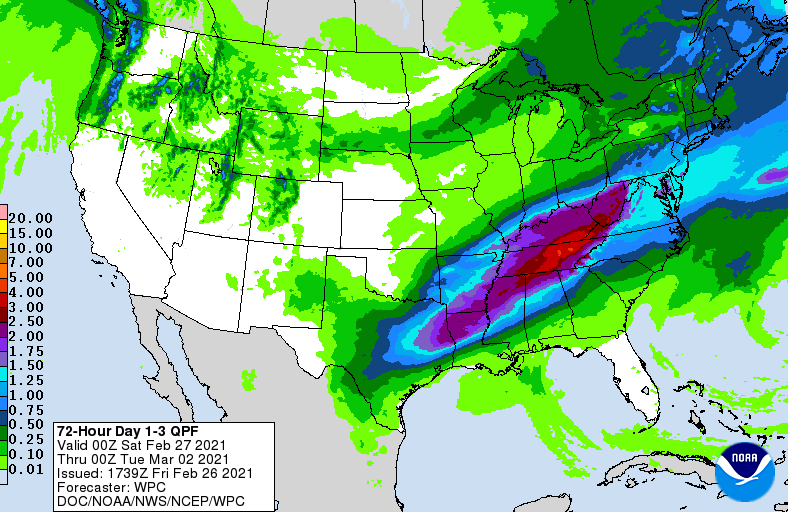 With flooding an increasing concern (especially the later part of the weekend), take the proper precautions now. Have a way to receive alerts for the latest watches, warnings, road conditions, etc. Remember to never drive through flooded roadways as they can quickly carry away your vehicle. This is in addition to the fact that water depth, movement/speed, and road conditions (or lack of) underneath are all unknowns. 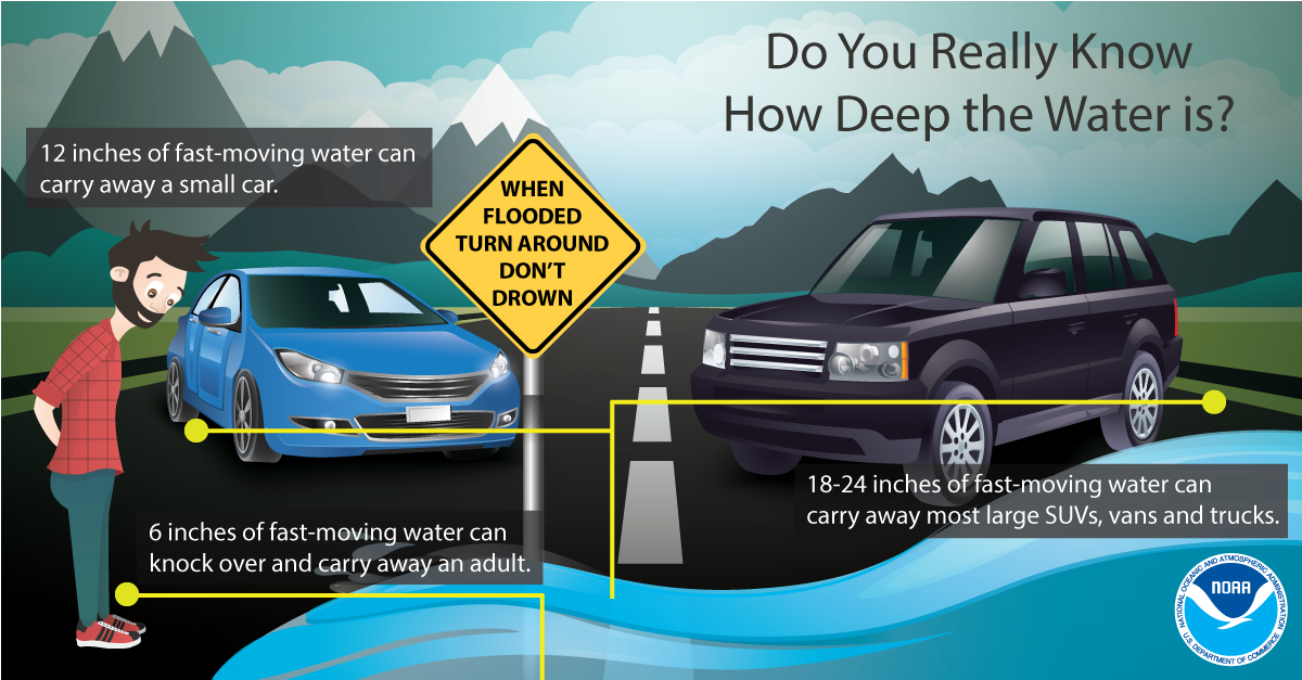 Remain alert this weekend, especially if you are in a flood prone area, near water bodies, or in low-lying areas. We will continue to monitor the track and give you the latest updates as they come in. For reports email [email protected] or tag us on our social media handles. Stay safe, stay smart, and do your best to stay dry. Pre-recorded for 5pm show
0 Comments
Leave a Reply. |