|
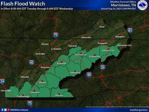
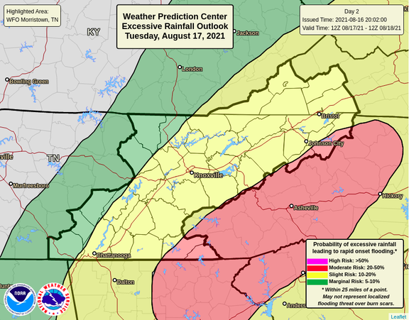
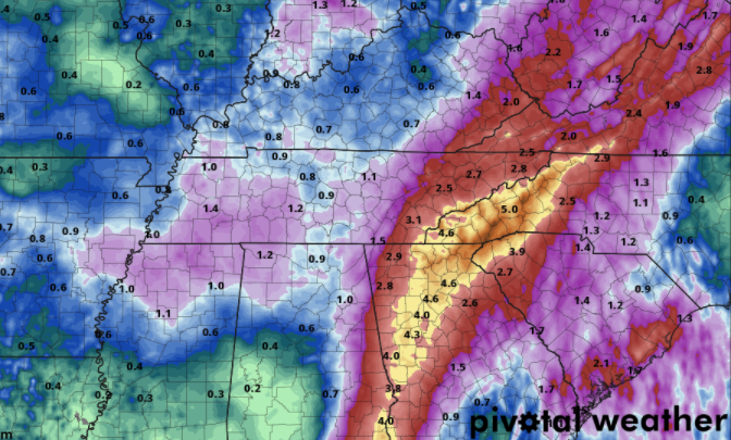
The outer bands of what's left of Fred are already seen across East Tennessee this morning. Because of the rainfall we have picked up the past several days and the heavy tropical moisture expected today, a Flash Flood Watch is in effect through tomorrow morning. This means heavy rain is expected for the highlighted counties with upwards of 4+ inches possible. Flash flooding is expected to occur, so be weary of warnings issued throughout the day and have a way to receive those alerts. The higher terrain of the Smokies will be impacted the most, but much of Eastern Tennessee will likely see a couple of inches of rain. To coincide with the flash flood watch, WPC has issued a slight (10-20%) for nearly all of East Tennessee. Our far eastern tips also include a moderate risk (20-50%) of flash flooding today. The bulk of rainfall will be on the eastern side of the Appalachians, but run off combined with fairly saturated soils is a bad combination. The rainfall outlook will range generally from 1-4 inches. Our far western counties will see the least impacts, while our eastern will see the most. As you can see, upwards of 5+ inches will be possible along the spine of the Appalachians today. This begins to drop off as you head further west. A bit of a lull will find us Wednesday as Fred exits north, but showers & thunderstorms quickly return for Thursday and the first half of the day Friday. Flash flooding will remain in question given the large amounts of rainfall through the past couple of days and expected in the days ahead. Pre-recorded for 5pm show
0 Comments
Leave a Reply. |
Your trusted source for everything weather in East Tennessee.
Social Media
|


