|
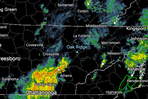
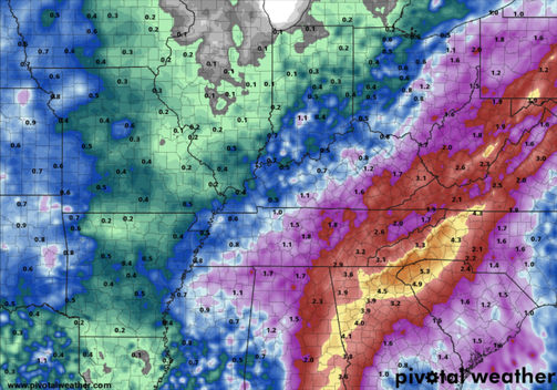
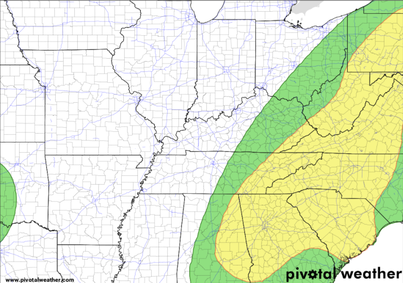
Scattered showers and a batch of moderate storms (Chattanooga) are falling this morning. These will strengthen some into this afternoon, mainly in areas that won't see much rainfall through the morning. A frontal boundary is working back north as Tropical Storm Fred is set to make landfall tonight and work north in the coming days. Looking at the WPC's expected rainfall, East Tennessee will range from 1 to 3 inches. My personal inclination would be for totals closer to 2-4+ inches, and that's only because of the rainfall expected today and with Fred towards midweek. Regardless, a slight risk (10-20%) of flash flooding is in place for our area each day through mid week. With moderate to heavy rainfall throughout the weekend and continuing into this morning, soils will continue to saturate, leading to flooding & flash flooding. Particularly low-lying areas (especially near water bodies) are most suited for this hazard. WIth that said, all should use caution as heavy rainfall could lead to ponding water quickly. It is noteworthy to also mention the path of Fred will make a big difference in how much rainfall we see. Models, in recent runs, have suggested a more eastward shift (good news for us) but things are likely to change so stay tuned for updates. Looking at future showers/storms, they will continue this afternoon before we get a bit of a lull overnight. Fred will then enter the area (to our south) by tomorrow, bringing showers on and off through the day and again through much of Wednesday. As mentioned, Fred working more eastward would be the best case scenario for us, as a more westward shift would result in much higher rainfall totals. With details regarding Fred still to be worked out, be sure to tune back in for updates. Follow us on Twitter/Facebook if you don't already (@SecretCityWx). Trends look positive, but guidance isn't truth and it will depend on how well the high off the Carolina Coast breaks down. The positive is we can at least enjoy some cooler air as well as some needed rainfall for our drier spots. Pre-recorded for 5pm show
0 Comments
Leave a Reply. |
Your trusted source for everything weather in East Tennessee.
Social Media
|


