|
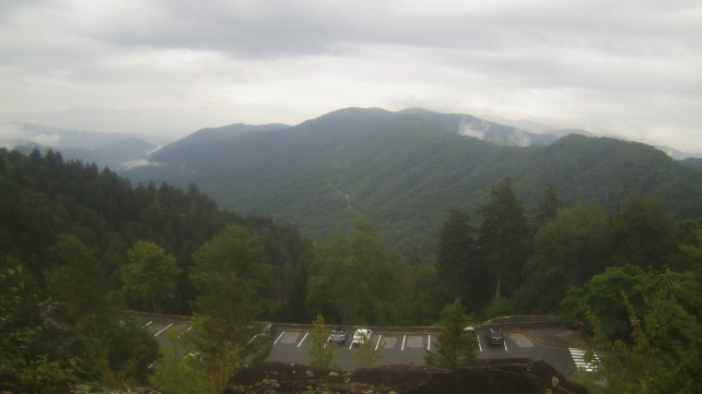
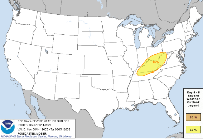
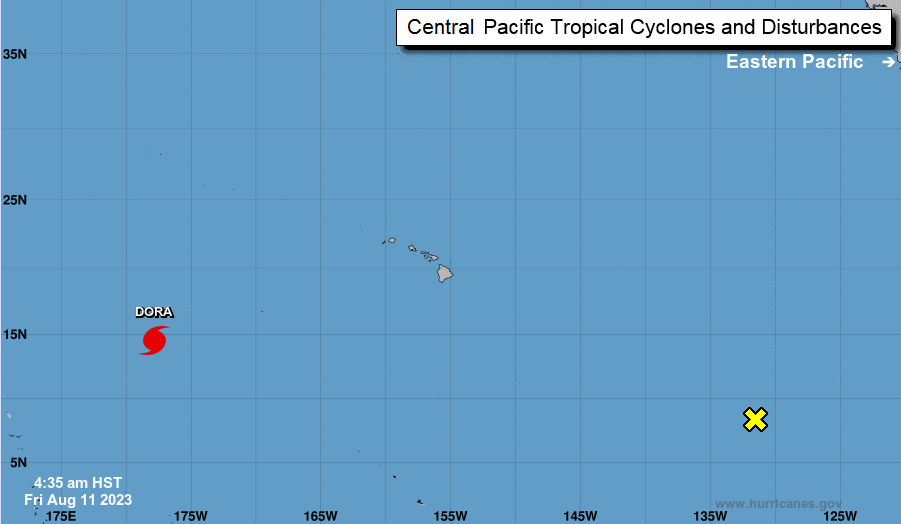
The Smokies are living up to their name early this afternoon, as low clouds and fog have been slow to burn off here. Across the valley, partly cloudy skies prevail, but spotty showers and storms are starting to pop up across the plateau and drift east. Activity will dissipate into tonight, leaving another opportunity for patchy dense fog into Saturday morning. Looking ahead, a series of approaching disturbances are in the forecast this weekend to early next week. Though a few strong storms and/or heavy rainers are possible Saturday and Sunday, the better chance will be Monday ahead of an approaching frontal boundary. The Storm Prediction Center has highlighted a Day 4 slight risk across the northern plateau, where a general risk is likely for at least a portion of the area as we get closer. There are some uncertainties in timing as well as available energy, something that will be closer inspected this weekend. For now, be weary of the threat during the afternoon hours of the new work week, with damaging wind gusts and some hail the main concerns. Drier air then returns toward midweek and beyond. Changing tune, Hawaii has been in the news lately for its wildfires- specifically across the island of Maui. A big player in that issue has been the winds from Pacific Hurricane Dora. A strong pressure gradient from the system has resulted in high winds, and thus, a lack of control in wildfire growth and spread across the island. The good news is this hurricane will continue westward today into the weekend, with resulting winds slackening across the island chain. This will enable crews to get better control of the wildfires, and hopefully put a close to the activity in the days to come. Scattered showers/storms will be possible this weekend, mainly during the afternoon and evening hours each day. Temperatures will also warm back up, topping out in the upper 80s to low 90s for some. Monday will be the best day to focus on in terms of strong or isolated severe chances, so tune back in for further details along with following on Twitter/Facebook. A few instances of flash flooding also can't be ruled out. Drier air then returns later Tuesday and towards midweek. Have a wonderful weekend everyone! Pre-recorded for 5pm weather broadcast
0 Comments
Leave a Reply. |
Your trusted source for everything weather in East Tennessee.
Social Media
|


