|
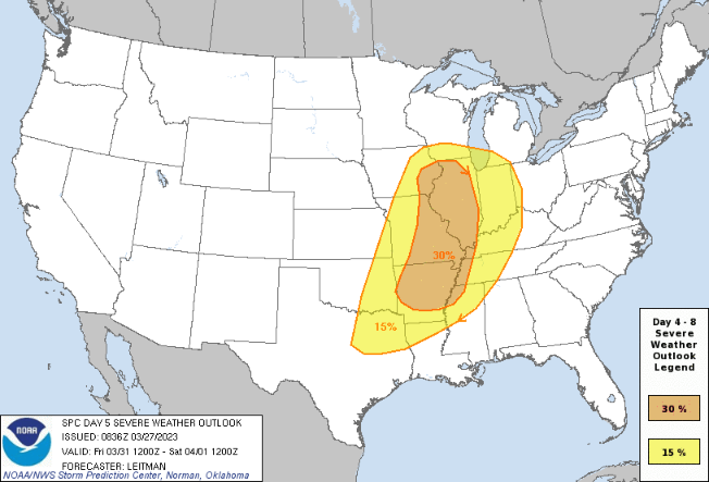
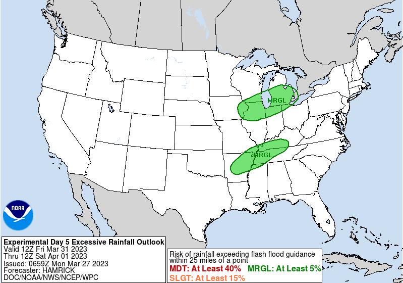
Good afternoon! A beautiful one it is with mostly sunny skies and temperatures ranging in the upper 60s to near 70. We will squeak out a couple of more degrees before days end, topping out in the low 70s across the valley. Generally moving forward we will see a cooling trend, with highs Tuesday in the mid 60s and Wednesday in the low 60s. Not to worry though, as low 60s are our typical average and we will see things warm right back up toward the weekend. Looking below, we are eyeing another storm system late week. Similar to this past storm system, we could see the opportunity for strong to severe storms and an isolated flash flooding threat. There is still a lot of details to smooth out but timing (for us) looks favorable, generally late Friday into early Saturday. Additionally, there could be a low end shot of flash flooding risk. With generally dry or low end rain amounts expected now through Thursday, this is likely very minimal at best. That said, within any strong thunderstorms and over any location that sees repeated activity, the risk can't be entirely ruled out. The break down this week is as follows: High pressure keeps things dry through tomorrow morning, before isolated shower/sprinkle chances find us Tuesday afternoon and evening. Drier conditions then return overnight Tuesday through Thursday with seasonable temperatures during this time. By Friday, a strong area of low pressure will glide north and west of the area, bringing the opportunity for strong storms Friday into Saturday ahead of a cold front. Stay tuned for more details to come. As mentioned, the timing (as of now) looks for favorable for a lesser severe risk but there remains medium spread in guidance solutions. For now, enjoy the generally dry weather over the next few days with highs near to just above average. Don't forget to check out our video forecast below for more details as well. Pre-recorded for 5pm weather broadcast
0 Comments
Leave a Reply. |
Your trusted source for everything weather in East Tennessee.
Social Media
|


