|
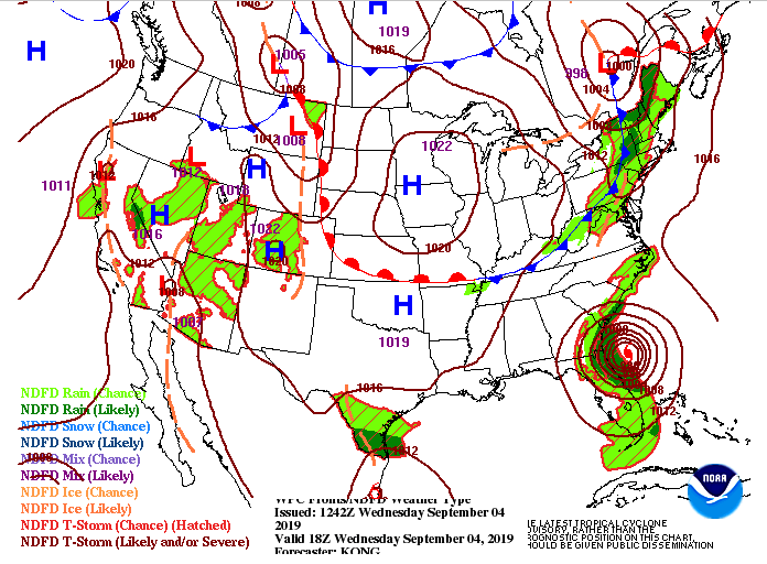
Happy "Hump Day" to everyone! It will be a hot one today as high's are expected to be in the mid to upper 90's. If we look at the expected heat indices though, temperatures could feel closer to the triple digits mark for parts of the valley; so remember your heat safety. As we get into tomorrow, those high's will be knocked down closer to the average for this time of the year. This is all due to a cold front (seen north of TN) that will push through tonight. Don't get too excited though, as this reprieve in temperatures won't last long. Friday and the weekend we will warm back up into the lower 90's under mostly sunny skies. As for our modeled guidance, we are pretty calm and dry over the next day or two. We could see an isolated shower or two develop in the northern portions of middle Tennessee (ahead of the cold front pushing through), but my expectations for this are low. With the dry atmosphere overhead, anything that develops will be light and short lasting. I hope everyone has a good rest of their Wednesday and remember to stay cool and well hydrated as the heat can "strike" quickly. Remember, we have added video broadcasts each day during the weekend you can check out below or on our YouTube Channel.
0 Comments
Leave a Reply. |
Your trusted source for everything weather in East Tennessee.
Social Media
|


