|
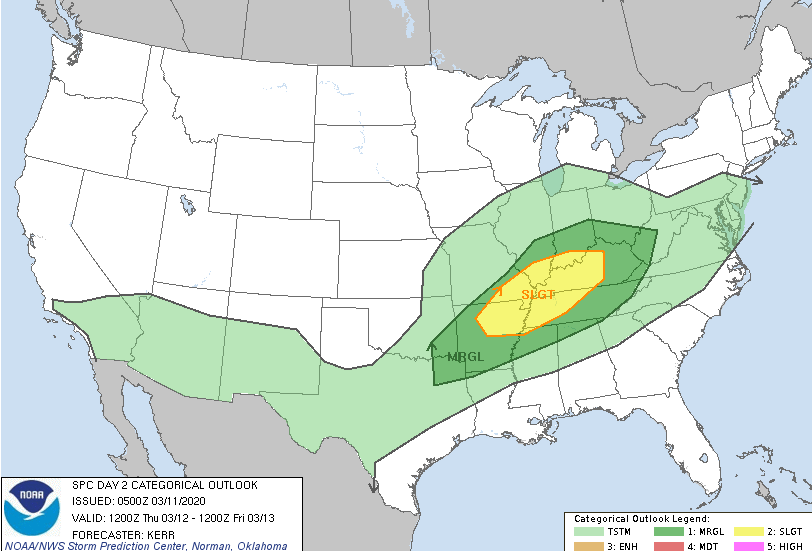
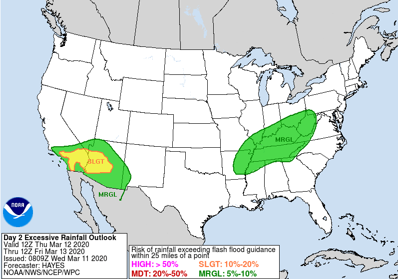
Check out the latest view from the Stansfield's cam. Not only is it finally not raining, but some peaks of sunshine are shinning through; take advantage! Showers will return tomorrow and parts of Friday and again throughout the weekend. The latest from the SPC shows severe potential for western TN and KY tomorrow afternoon and evening with only a marginal risk for our neck of the woods. The bulk of heavy showers and storms will stay to the north but damaging winds are something we'll be watching for here at home. As with all severe weather outlooks, isolated spin-up is something we can't forget about but potential is low. Along with the SPC outlook, the WPC has provided a marginal risk of flash flooding across Tennessee and Kentucky. Isolated flash flooding is possible in heavier showers tomorrow, so be weary if in flood prone areas. The latest model guidance runs shows the waves of showers and storms working throughout tomorrow and Friday. Friday afternoon we will begin to dry back out, continuing into Saturday morning. Unfortunately, another round of shower activity arrives for Sunday and early next week. As mentioned yesterday, this pattern of scattered showers looks to stick around for the next several days so keep the umbrellas handy. That concludes the forecast for today but be sure to check in for the latest in regard to any severe potential tomorrow afternoon.
0 Comments
Leave a Reply. |
Your trusted source for everything weather in East Tennessee.
Social Media
|


