|
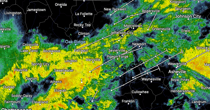
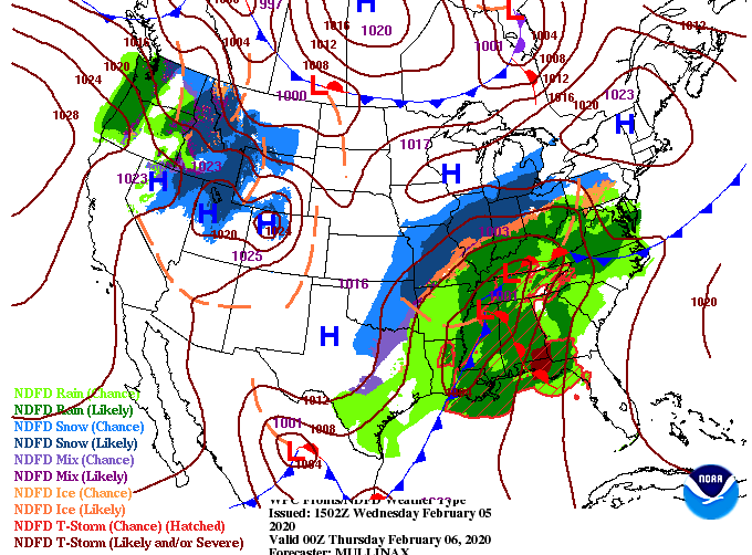
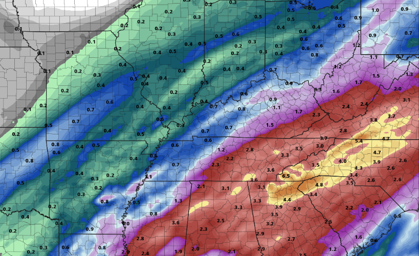
I hope you are staying dry outside! Showers are set to continue this afternoon and Thursday. The latest radar scan shows moderate showers working from the southwest. Unfortunately, we won't begin drying out until Friday afternoon and then again on Sunday. Looking below, the second low pressure system has worked in and will bring heavier showers and storms overnight and into tomorrow. Though the severe threat is low, be weary of damaging winds and flash flooding. The southern Valley and southern Plateau could feel the worst of the showers/storms tonight, but as I said, severe potential remains low. The main concern for east TN, now through Friday, will be flash flooding. NWS Morristown has issued an active Flash Flood Watch until 1am Friday morning. Something to take notice of is the colder air moving in tomorrow afternoon. High's for the day will come early, leaving temps in the low to mid 50's by the evening commute hours. As anticipated, showers will continue into Thursday with the chance for snow showers overnight Thursday and early into Friday. As of the latest data, little impacts will be associated here in the valley. With warm ground temperatures and only a brief period of snow potential, expect little to no accumulation. Another round of showers & snow potential return Saturday morning but this one will move through much quicker. As of noon today, the office here has picked up over an inch of rainfall. Looking ahead, another 2+ inches is expected tonight and through Thursday. Flash flooding and flooding in general can quickly become a major hazard so remain weather aware if you live in low-lying areas. As always, we will continue to update you on the latest regarding the heavy rainfall, limited severe threat, and minimal snow potential the next couple of days. Until then, stay safe and dry as we work into Thursday!
0 Comments
Leave a Reply. |
Your trusted source for everything weather in East Tennessee.
Social Media
|


