|
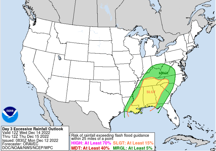
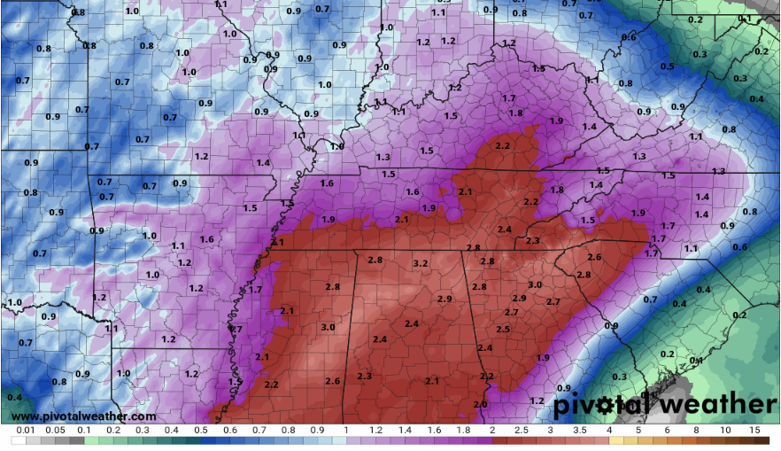
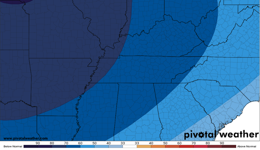
Much clearer news as it relates to the system we have been talking about since last week. But up first, how about the sunshine! After a week of on and off rain and thick clouds, that big ball in the sky has again shown itself. Temperatures will be near average today and tomorrow, topping out in the mid 50s both days. Now, back to this system mid week. It will be a strong area of low pressure across the Plains, bringing strong and severe storms (more than likely) to the Lower Mississippi Valley tomorrow. Luckily, this system weakens east. Though this is good news for severe weather (very low), the threat of heavy rainfall isn't ruled out. In fact, the WPC has highlighted a Day 3 slight risk of flash flooding. We will have had a few days to dry out from our previous rain, but given the 2-5" some areas picked up through this past week, it is still concerning. Rainfall rates with this next system will vary but 1" per hour can't be ruled out ahead of the approaching cold front. Luckily, this system is fairly progressive (quick moving) but any heavy showers that continue to cross the same area (training) could lead to issues. Right now, the rainfall outlook will be between 2-3" from late Tuesday night through early Thursday afternoon, but locally higher amounts will be possible. Begin planning now if you live in flood/flash flood areas and have a game plan if warnings were to be issued in your area mid week. This will be a very strong cold front, with reinforcing cold air longer term. Looking at the CPC outlook for the second half of December, cold air looks to stay socked in through this time, with chances much higher than average. I have even seen some raw model outputs circulating around about Christmas and cold air and snow....PLEASE take these will a large grain of salt and know weather prediction this far out is nearly impossible and that these graphics folks show are highly likely to change. With that said, yes chances are things will be below average (temperatures) which favors the chance for snow, but time will tell how it all pans out and we'll be here to let you know as we get closer! That will do it for today, be sure to enjoy the sunshine. Clouds increase back tomorrow, leading to periods of heavy rain Wednesday and early Thursday. Drier and much cooler conditions then filter in Friday and through this upcoming weekend. Pre-recorded for 5pm weather broadcast
0 Comments
Leave a Reply. |
Your trusted source for everything weather in East Tennessee.
Social Media
|


