|
We've seen a few isolated showers so far early this morning, otherwise things have stayed cloudy. Working into the day, showers will become more widespread and the intensity will also pick up. As of last night, the WPC has placed all of East Tennessee under a Slight risk (10-20%) chance for flash flooding. Given model trends, especially the higher resolution short term ones, I would not be surprised to see the WPC up some areas to a moderate risk. We will keep a close eye throughout the day and keep you posted. 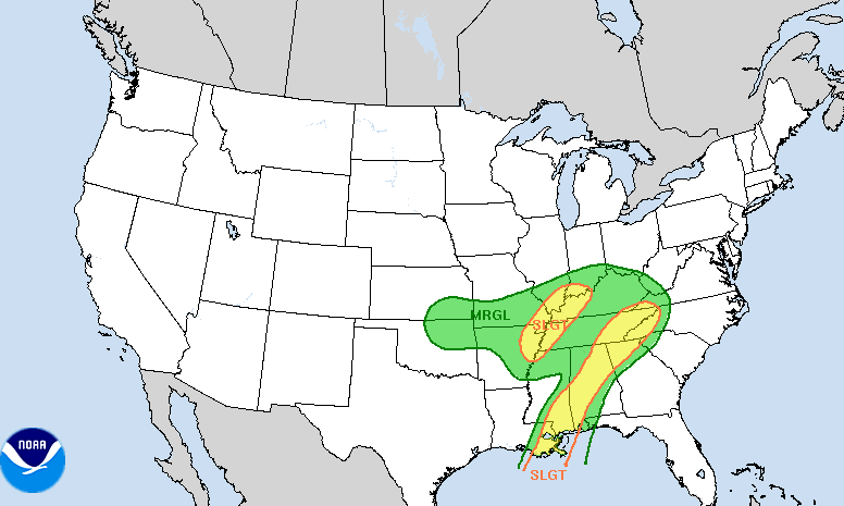 For now, a pair of low's, one to the west and the other (Zeta) from the south, will bring heavy rainfall across all of the Mid-Atlantic states. Particularly here at home, trends have agreed to the more eastward orientation & path as I likely hinted would be the case yesterday. With Zeta likely working right through parts of East Tennessee, heavy rainfall will impact us overnight. With the rainfall we will see throughout the day toppled with a heavy dose overnight, flash flooding could quickly become a concern into early Thursday. Be sure to have a way to receive alerts if you are in flood prone areas. As of this morning, NWS Morristown has issues a Flash Flood Watch for the entire area running from 8pm tonight to 2pm Thursday.  A nice dose of rainfall is expected across the entire region, but things will likely be the heaviest across our area. Current models are trending between the 2 and 4 inch mark with locally higher amounts of 5+ inches possible in some locations. The good thing is we have been quite dry this week, so I am hoping this helps reduce flooding potential. If you would like to send us reports, you may do so by email [email protected] or through social media. We will also pass those along to the NWS. 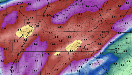 Once Zeta is all said and done, a high pressure system and much cooler air arrives Friday. High's are expected to top out in the 50's under clearing skies. Looking longer term, a secondary blast of cold air arrives late Sunday bringing the coldest air of the season. Temperatures to start the morning Monday will be in the 20's (for higher elevations) to lower 30's here in the valley. I anticipate a frost &/or freeze warning to be issued across the area (ending the growing season officially). 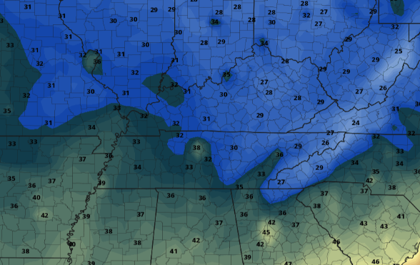 With lots of weather expected the next several days, keep up to date here and through our social media pages. With heavy rainfall expected through today and tonight, have a way to receive alerts. For more information check out the video forecast below as well as last night's video forecast (geared toward Zeta). Pre-recorded for 5pm show
0 Comments
Leave a Reply. |