|
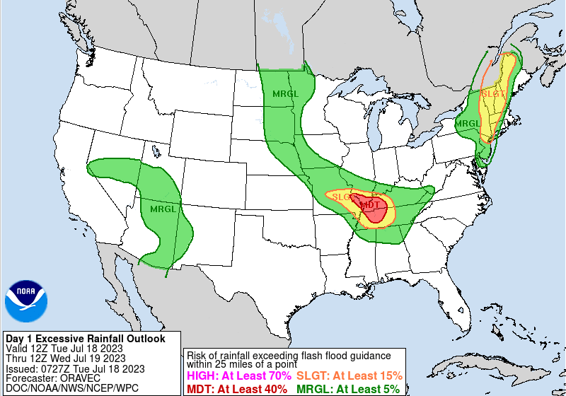
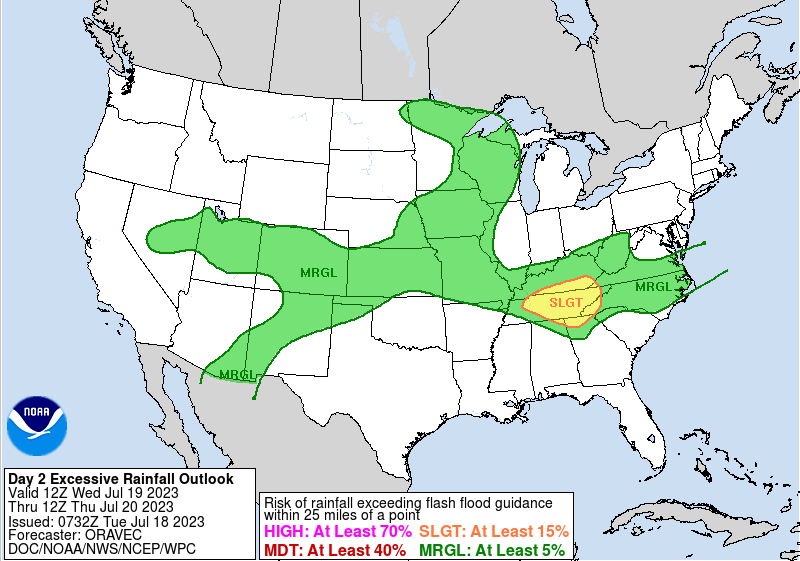
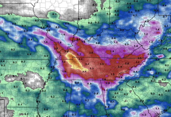
The weather concerns moving forward remain relatively the same. Flash flooding risks will grow through the week, and even a few strong or severe storms will be possible during this time. Looking below, the flash flood risk is Moderate (at least a 40% chance of occurrence) for portions of West TN and KY today. The complex that will affect this portion of the state will eventually move into our neck of the woods tonight. Keep in mind there is still quite a bit of uncertainty in the true path of this swath of storms, as some guidance has it staying further west, while others right across East Tennessee. Given this, prepare now for the chance of having heavy downpours, rising water basins, and flash flooding. Into Wednesday, the risk grows to a slight risk across us, where a continued flash flooding risk remains through the day Friday when the boundary FINALLY pushes south of the state. Looking at the suggested mean rainfall amounts through Friday, things have gone up since yesterday. We are now looking at amounts between 2 and 4 inches, with locally higher amounts certainly possible. Again, given the uncertainty in how this thunderstorm activity pans out each day we could see an uptick in amounts or just the opposite. In terms of timing of waves of showers or storms, isolated activity is on going this morning. We will see an increase in coverage this afternoon, where the mentioned complex could impact the area this evening and through the night. Another round of showers and storms then finds us Wednesday followed again by activity Wednesday night into Thursday. Lastly, the frontal boundary to the north will break south where one last shot at rainfall arrives Thursday into Friday. Drier air then returns into Saturday and Sunday, with temperatures also cooler through the weekend. Be weather aware over the next several days. A series of passing disturbances will progress through the area, bringing a flash flooding and isolated severe risk. Heavy rainfall, frequent lightning, gusty winds, and some hail will be possible at times today through the rest of the work week.
0 Comments
Leave a Reply. |
Your trusted source for everything weather in East Tennessee.
Social Media
|


