|
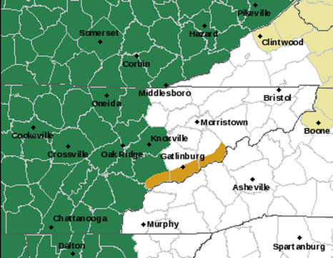
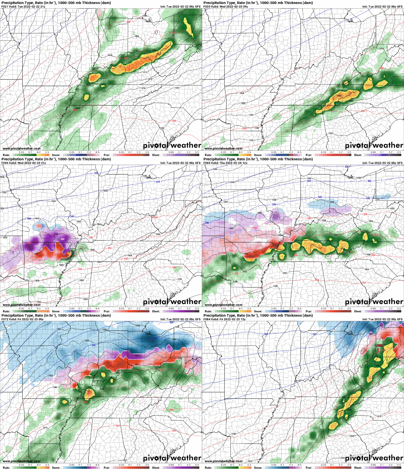
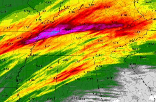
Good morning! Most of the rainfall has vacated, through a few scattered showers throughout the day are possible. For the most part, today will be cloudy and breezy. Winds out of the southwest will blow between 5-15 with gusts up to 25 mph. As we work into tonight, heavy showers and a few storms will work in. Due to the heavy nature expected, a flood watch has been issued until tomorrow night at 7pm for the areas highlighted in green. Prepare now if you are in flood prone areas and have a way to receive alerts. Breaking it down, a heavy band of showers and isolated storms will pivot across the area tonight. As this axes shifts east, we'll see a lull in activity once again for Wednesday. A secondary system will then work in bringing cooler air on the tail end. This will arrive late Wednesday night and through Thursday. Again, 1-3" will be possible with this system, bringing a grand total of up to 5-7" in total. This biggest uncertainty is where the heaviest band sets up and eventually pivots. Earlier runs pinned this further north but more recent runs have this a bit further south. If this trend continues, we could see this lined up across portions of Tennessee, and this could cause significant issues. Red's highlight 2-3 inches, while purple signifies 4-5+ inches. Keep in mind this is through Wednesday night and doesn't include most of the second system rainfall. This is also a raw model run, meaning take it with a grain of salt. Furthermore, other higher resolution models indicate much less rainfall overall, in the 1-2" ball park. We will see how things play out, but the best opportunity will be just north and west. We will continue to keep a close eye on this, but have a way to receive alerts and prepare now as if flooding is expected. Those in low lying areas, near water bodies, or near common flood points will be the most at risk. Cooler and drier air will find us early weekend, before more shower opportunities find us Saturday night and into Sunday.
0 Comments
Leave a Reply. |
Your trusted source for everything weather in East Tennessee.
Social Media
|


