|
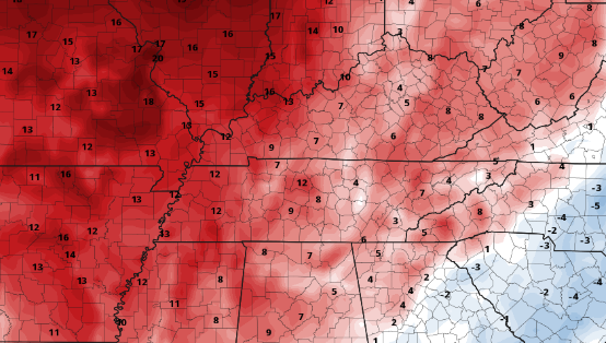
Good morning! After a very active end to the work week last week, we start this one calm, warm, and quiet. Satellite this morning depicts only a few high clouds streaming through and some patchy valley fog. As we push into this afternoon, mostly sunny skies will return with highs in the upper 70s to around 80 degrees. Moving forward this week, there are little changes that can be expected. Highs will generally average above the norm, with temperatures Wednesday and Thursday 5-10 degrees above average. Some could even see the 90s before days end too. Altogether, high pressure will look to keep things warm and mostly clear the next couple of days. The one exception will be Thursday and onward, where an isolated shower/storm could arrive in the afternoon. Most will look to stay dry through. That will do it for now! We go almost opposite to the rainfall/storms we saw nearly every day last week and stay mostly sunny and warm this week. Have a good one and go out and enjoy this weather! Pre-recorded for 5pm show
0 Comments
Leave a Reply. |
Your trusted source for everything weather in East Tennessee.
Social Media
|


