|
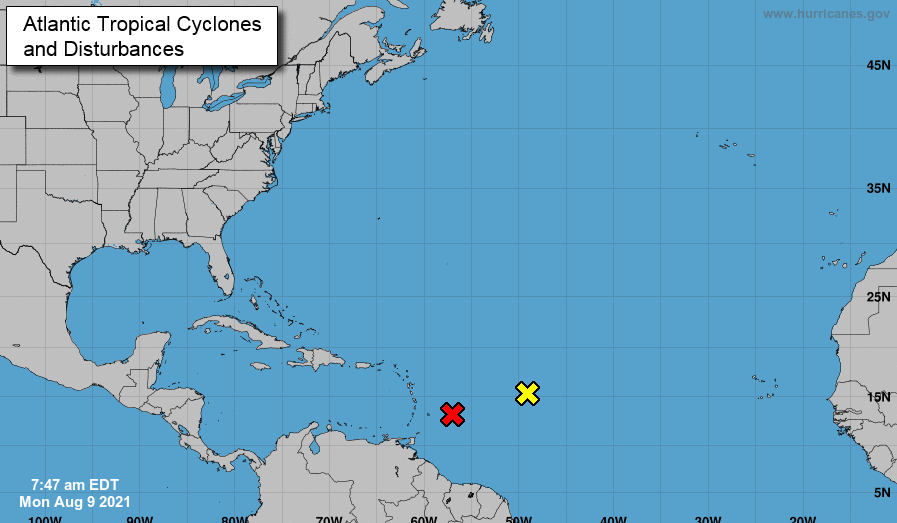
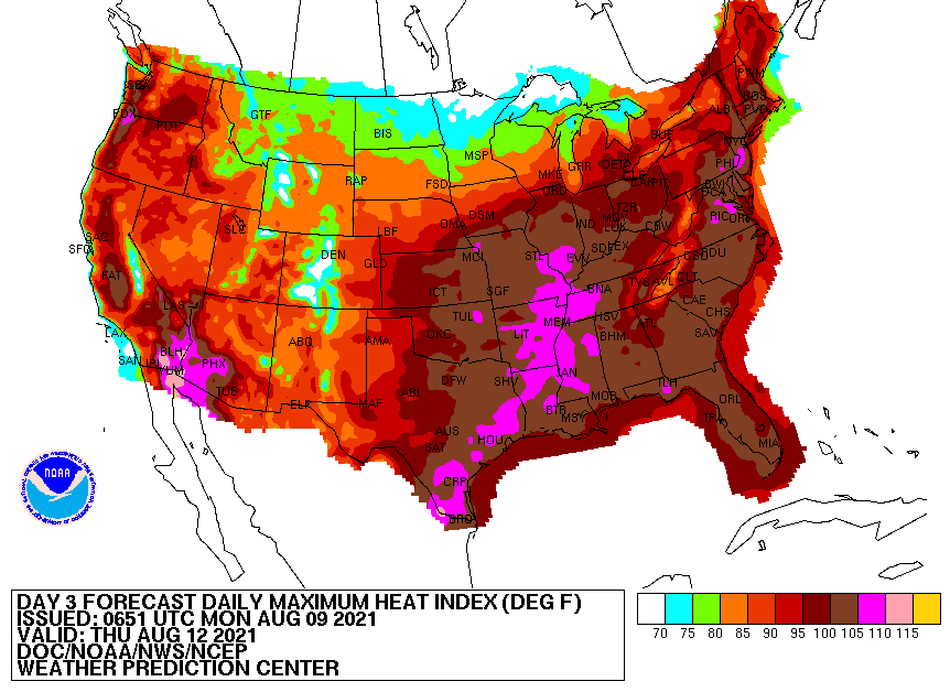
Starting the new work week off with the Tropics, two disturbances are seen just north of South America. The red "X" indicates a greater than 60% chance of tropical development within the next 2 days, while the yellow indicates a less than 40% chance. That being said, a Tropical Depression is likely to form over the next day or so. In additional to daily shower & thunderstorm chances, the heat and humidity will play a big daily roll. Looking below, feel-like temperatures are expected to be in the 105-110 range across portions of Middle and Western TN, and 95 to 100 range across East TN. Unfortunately, these will be the daily heat indices through the work week. Keep your heat safety in mind as it won't be a shock to see 100 degrees registered on the heat index today or in the days ahead. As mentioned, showers and storms will be possible each day. A series of upper level troughs will pivot across the region this week, bringing opportunities for activity each day. With precipitable water values fairly high (for this time of the year), we could see localized flooding in some storms. Confidence is low on any severe activity as well, but can't be ruled out (especially for the afternoon/early evening hours). Be sure to check in and have a way to receive warnings if any are issued. We'll provide updates via Twitter/Facebook so give us a follow if you don't already! Unsettled weather will find us much of the week with heat and humidity to also be a bother. Do your best to stay cool, hydrated, and dry through at least Friday. Pre-recorded for 5pm show
0 Comments
Leave a Reply. |
Your trusted source for everything weather in East Tennessee.
Social Media
|


