|
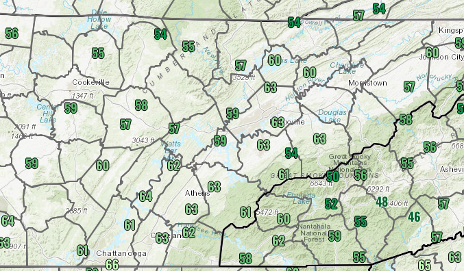
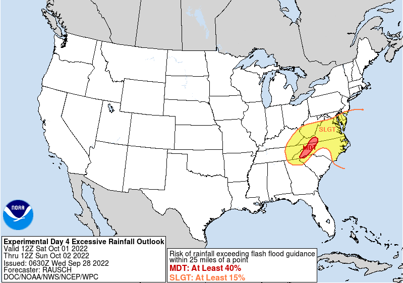
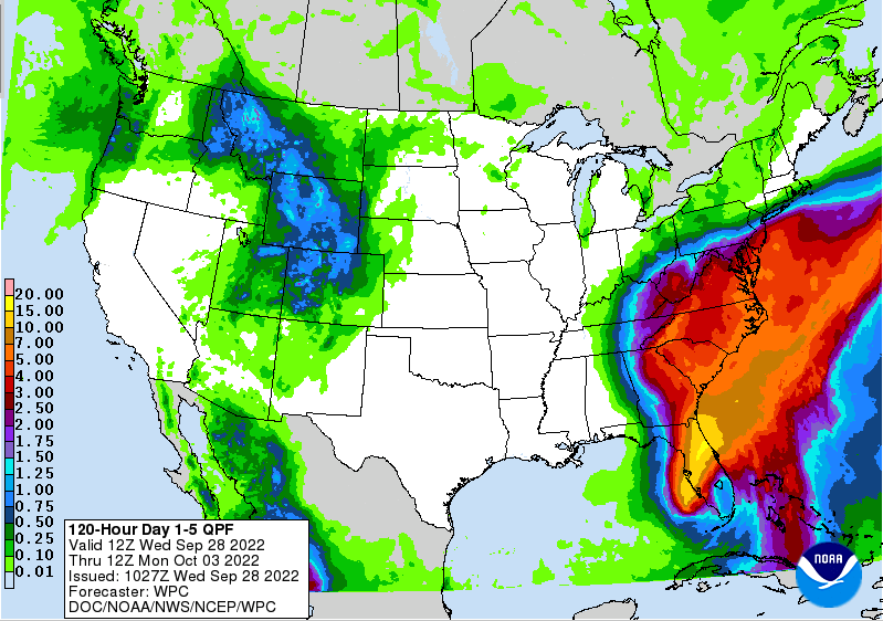
Check out noon time temperatures! Only in the upper 50s and low 60s, so you are in for a cool day. Highs are expected to top out in the mid and upper 60s today under mostly sunny skies. Moving forward, quiet and calm conditions stay in the forecast through most of Friday, before hurricane Ian works its way northward. Currently just a few miles off the Florida coast, Ian is expected to make landfall within the next half hour just south of Tampa. At a current category 4, Ian is on the brink of cat 5 strength, with current winds of 155 mph. Life threatening storm surge, tremendous rainfall, and winds over 150 mph should be expected. This system is anticipated to work northeast through Florida, wrapping into Georgia, and eventually through the East Coast states. Because of the heavy rainfall associated with the system, the Weather Prediction Center has highlighted a slight risk of flash flooding for all of East Tennessee Saturday morning through Sunday morning. There is still some question on exact path, but heavy rainfall is expected at times this weekend. Breaking this system down, Ian will make landfall near Tampa, working northeast across the state and then veering back westward into Georgia. Guidance varies on how far west the track of this system goes, but if this does track into the Tennessee Valley a bit sooner, this could mean lots of rainfall. Based on the data given, it seems fit that this will track just east of the Appalachians, before making its way into portions of Eastern Kentucky and into the Ohio Valley. Assuming this is true, northeast TN will more than likely see the heaviest rainfall Friday and through the weekend. Be alert and have a way to receive watches/warnings. The biggest risk will be with rainfall and the flash flooding/flooding associated. Though some gusty winds can't be ruled out, the rain is the big concern. Looking at rainfall amounts Friday and through the weekend, the East Coast could see up to 5 inches or more, while East Tennessee picks up between 1 and 3. Again, the exact path is not etched out yet, so any westward shift could lead to higher amounts, while an eastward pull would result in lesser totals. Stay tuned for further updates! Stay tuned for updates ahead. Changes are likely, which could bring variations in the current forecast. For now, 1-3" (from west to east) are expected with locally higher amounts possible. Enjoy the early Fall cool airmass, before remnants of Ian arrive late Friday and through the weekend. Pre-recorded for 5pm weather broadcast
0 Comments
Leave a Reply. |
Your trusted source for everything weather in East Tennessee.
Social Media
|


