|
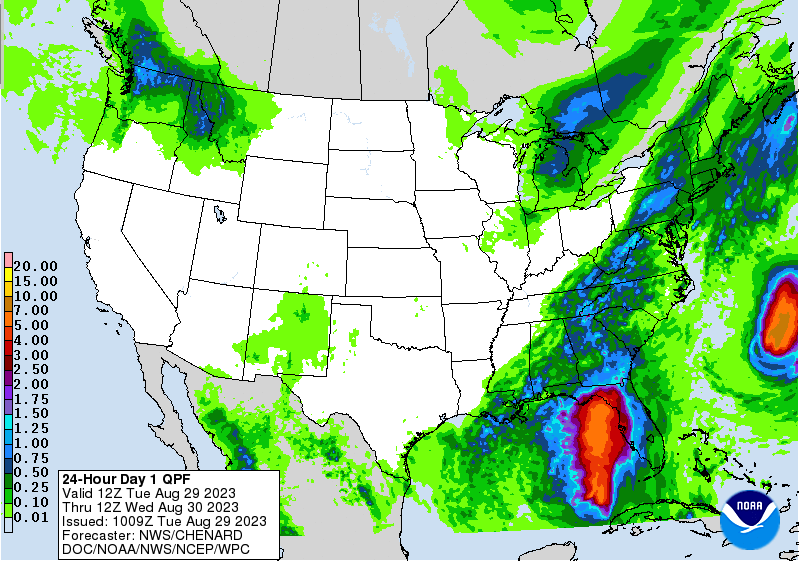
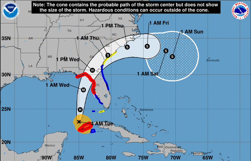
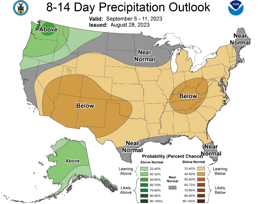
Good morning! Showers and storms are already ramped up, with activity on going across SE Tennessee to Maryville this morning, with scattered showers in the plateau. Expect for most locations to see a bit of rainfall today, some of which could be heavy. Isolated flooding can't be ruled out. As you can see below, rainfall amounts are expected to vary between a quarter of an inch to an inch and a quarter depending on where you are. Those further south and east (closer to the boundary) will see the highest rainfall amounts, while those further north and west generally can expect less. After this, an extended stretch of dry weather looks likely (more on this below). After this sluggish boundary dips south into tonight, Hurricane Idalia will make landfall midday Wednesday across the armpit of Florida. We expect this to rapidly intensify in the warm Gulf waters today, where The National Hurricane Center has this making landfall as a major hurricane (category 3 or higher). We think a category 3 or 4 is likely, with a 5 not entirely out of the cards. Something worth monitoring over the next 24-36 hours. Reach out to family/friends in these areas and come up with a game plan- in guidance with local officials. Significant flooding, hurricane force winds, tornado potential, and more all associated with this system. In terms of impacts locally, there will be minimal. Idalia will bend northeast with time, where increased high clouds will be noted across East Tennessee. A few locations in the far south/east could see isolated to scattered showers, but most of the area will stay dry Wednesday. High pressure then fills in Wednesday night, bringing dry and warming weather through at least early to mid next week. In fact, this comes from the Climate Prediction Center. Following along with what has been said, an extended dry period is expected. High pressure will shift east with time, squeezing out any rainfall chances through at least early next week. This is well reflected by the higher confidence of below average rainfall, along with (not shown) high confidence in above average temperatures. We could see values back up in the upper 80s to low or mid 90s a week out from now. Don't forget to view our video forecast below more even more information. Once we make it through today, and for a portion of the area tomorrow, dry and warming temperatures are on the plate for the foreseeable future. Have a good one, stay dry today, and enjoy the weather heading into mid and late week. Pre-recorded for 5pm weather broadcast
0 Comments
Leave a Reply. |
Your trusted source for everything weather in East Tennessee.
Social Media
|


