|
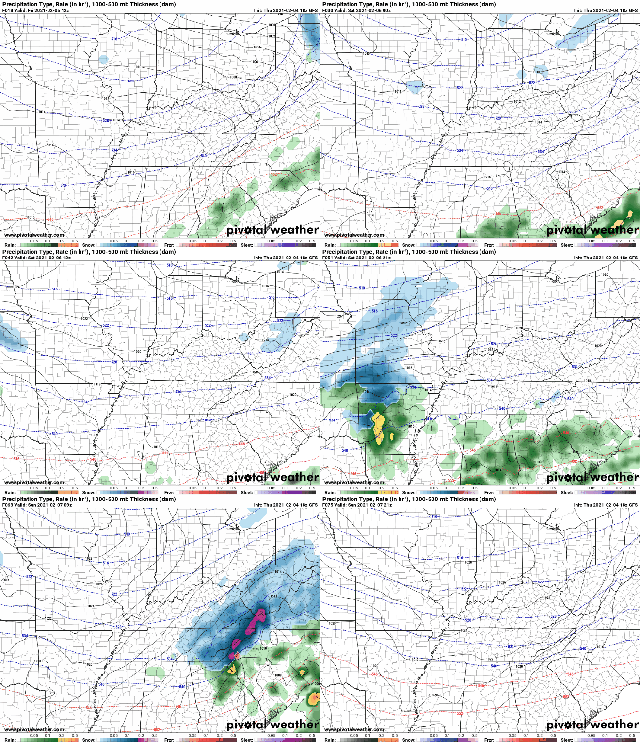
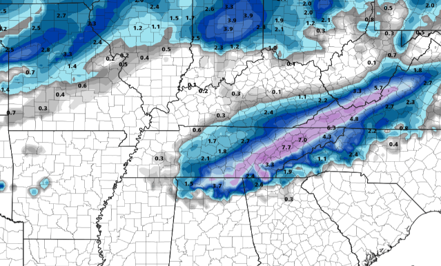
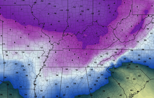
Showers retreated early this morning allowing for a pleasant morning commute. Working through the day we should see ample sunshine with temperatures topping out in the mid to upper 40's. Working ahead, we have lots to discuss. First, snow has been something folks are asking about for this weekend. Breaking this down, a low to our south has shifted a bit further north with its trajectory. This is typically good news as it leaves us in the wake of the cold sector of the low. However, due to insufficient moisture and valley temperatures, I do not expect much in the "snow department". Continue below for more. In reality I anticipate some scattered rain Saturday night into Sunday morning with a chance for a mix in the morning hours. At best, we will see a light coating on grassy surfaces, trees, and stationary vehicles. As Sunday progresses onward, sunshine and seasonable warm temperatures will be about for the afternoon. Continuing with the snow theme rumored by some, model run one I (image 1) suggests a 7 inch snowfall across the heart of East Tennessee Saturday night. This would be a very rare event to begin with and analyzing the environment Saturday night into Sunday shows insufficient characteristics. In this case, temperatures will hover right around freezing for nearly 2 kilometers (over 6,000 ft) before precipitation reaches the ground. Climatologically and the latest trends for Valley locations, this will likely melt any snowflakes to all rain by the time they reach the ground. If we compare our analysis to "image 2", we find an ensemble forecast (many model runs compiled together). The black line indicates the "mean" or average of the runs. As you can see, the mean lies at a couple tenths of an inch. As mentioned above, the best case scenario will likely be a light coating of snow (a few tenths of an inch). To put this all together short and sweet, my confidence is very low in a "big" snowfall. At best, we will see a light coating of snow before it quickly melts off during the day. The most likely outcome? Scattered rain with some mixing early Sunday morning and then sunshine in the afternoon (no accumulation). The forecast is much more snow oriented for the Smokies as this is an entirely different environment. If you would like more details on this explanation or what the forecast will be for the Smokies, shoot us an email at [email protected] To wrap this all up, cold air is still on the way. Assumptions were this swing would arrive early to mid this week but that has been pushed out a few extra days. This pivot in the pattern will bring in the opportunity for extremely cold air late next week. Changes are likely with this so don't hold your breath entirely on the temperatures below, but use them as reference for the chances we could see a week from today. Hopefully you have a sound understanding of what you can expect this weekend and ahead. As someone who enjoys weather, I pride myself on giving the best, most thorough, and easy to read explanation for my viewers (you). Many who just want the weather likely will by-pass much of the explanation for information that will impact them (and that's perfectly fine). We would like to incorporate what you enjoy & gain the most from so please don't hesitate to give us feedback along the way! Again, I apologize for the long post but I hope I covered what's ahead so that you can plan your days accordingly. Have a great weekend! Pre-recorded for 5pm show
0 Comments
Leave a Reply. |
Your trusted source for everything weather in East Tennessee.
Social Media
|


