|
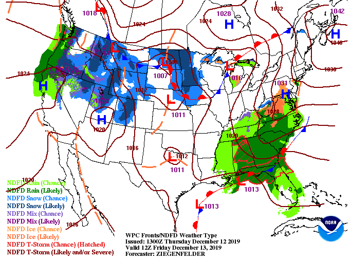
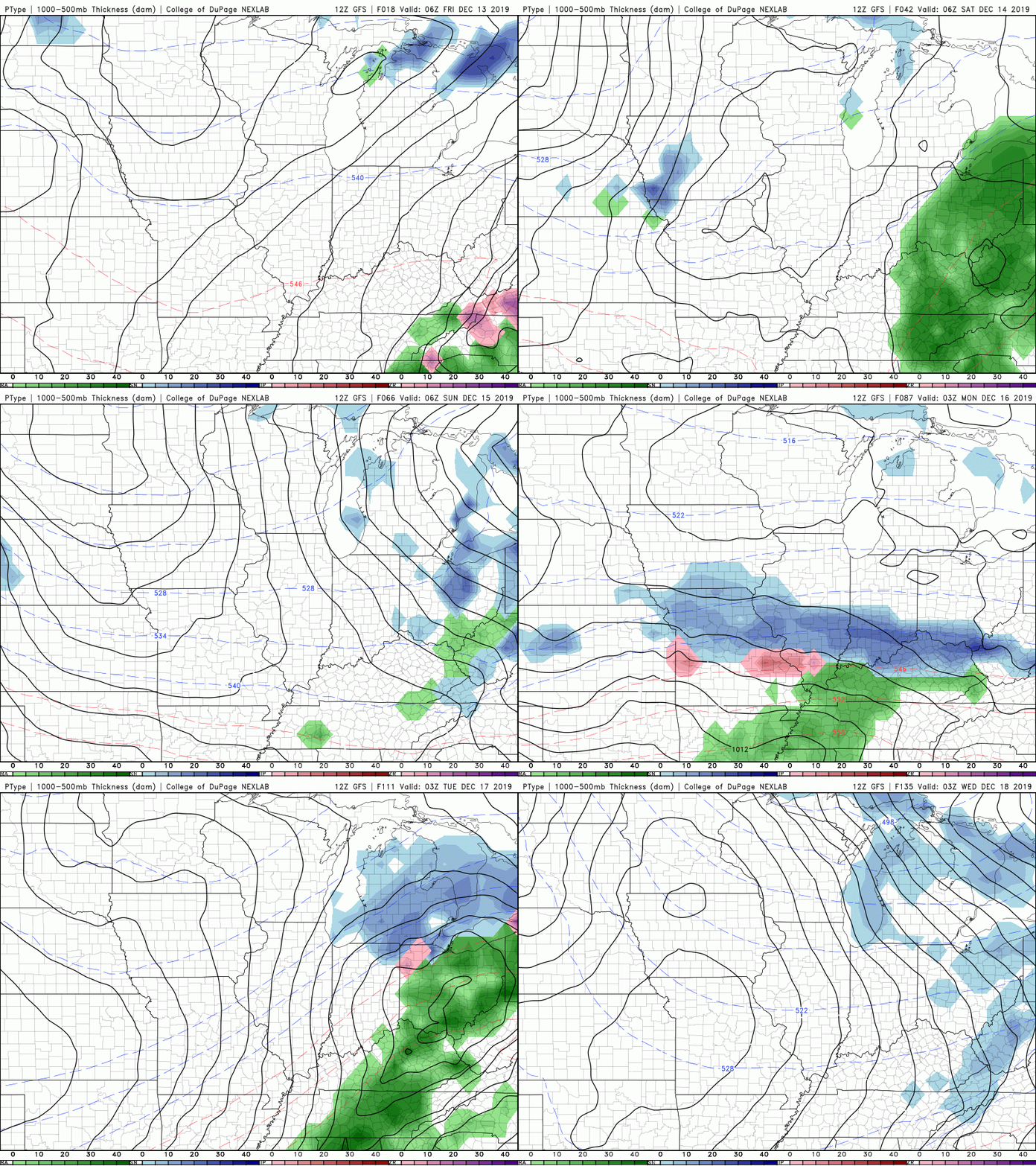
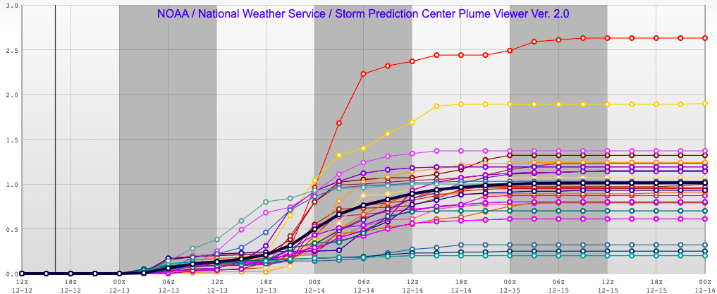
Good afternoon! As a low continues to track north, rain will continue to fall through the day today and into Saturday. Most showers will be scattered and light, with steadier amounts arriving this evening and overnight. A brief break will come Sunday before another system to the west arrives by the start of the new work week. As model guidance is suggesting, and what we have seen so far, showers will remain scattered through the daytime hours. Working into tonight, showers will pick up and become more widespread. This will carry into Saturday before moving out tomorrow afternoon and overnight. Sunday we will stay dry most of the day before showers return overnight and into Monday. This second system will eventually move out early Tuesday leaving cooler and drier air for the remainder of next week. The latest data suggests up to an inch of rainfall throughout east TN through Saturday afternoon. Up to now, most of east Tennessee has received 0.1-0.2 inches of rainfall today. With heavier and more widespread showers arriving tonight, I am tending to agree with the latest data outputs. For clarification, this is what is known as a PLUME. Essentially this is a model outputting ensemble data for a specific variable (this case precipitation amounts). Ensemble means multiple runs of the model with slightly different initial conditions. In an easier sense, the data below is a single model (SREF) suggesting the rainfall for the next 2 days. Instead of a single output seen on your typical graphical model, ensembles change the initial conditions for each run creating a slew of results. The mean of the runs is then used and expressed as the mostly likely result. This is very similar to hurricane models and spaghetti plots. The "cone" provided by the NHC is the average (or most likely path) the hurricane will follow. The middle of the cone is the most likely path but anywhere within the cone is possible. Hence why the closer in time the more confidence (smaller/tighter cone) and the further out, the wider the cone is with less confidence. If you have any further questions about ensemble data or weather as a whole don't hesitate to ask. For now, stay dry as rain continues to be in the forecast for the next several days. Have a good weekend!
0 Comments
Leave a Reply. |
Your trusted source for everything weather in East Tennessee.
Social Media
|


