|
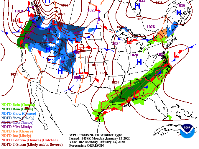
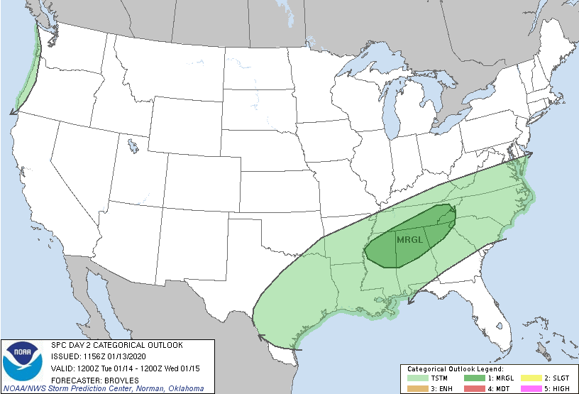
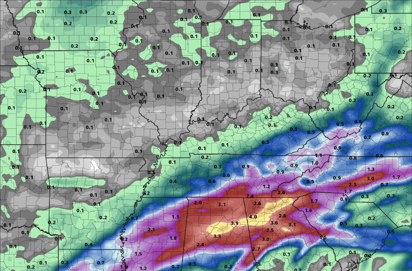
I hope you are having a good Monday so far! As we push into the PM hours, cloud cover will continue moving in from the south. Seen below, a system to the south will bring in showers and a few storms the next couple of days. Model guidance precipitation, as well as totals, continue to decrease, but given the latest data expect showers to move in late overnight tonight. This next system will not be a washout filled with day long rain events, but instead, on and off pockets of showers and rumbles of thunder. These scattered showers (and some storms) will eventually push out entirely by Thursday morning. Though confidence remains low on severe weather, pockets of heavier showers and storms are expected to move through tomorrow morning. The biggest concern will be areas of strong winds but like any severe system, isolated spin-up is possible. To add to a marginal risk (1/5) of severe weather, the timing of the heavier showers/storms comes during the morning commute hours. Be sure to account for wet roads and moderate/heavy rainfall as this will play a roll on traffic speeds. The main line of this system will stay south leaving upwards of an inch to an inch and a quarter now through Thursday (for the central valley). Earlier models had this system pushing further north, accounting for higher rainfall totals, but model guidance continues to trend downward. If you are to the south (Chattanooga), expect higher amounts up to 3 inches through the day Thursday. Be careful in the morning hours tomorrow as we are expecting moderate to heavy showers and storms. By the PM hours, showers will be scattered with high's in the mid to upper 60's. Keep the umbrellas handy much of this week; it won't be a washout, but it won't be dry either.
0 Comments
Leave a Reply. |
Your trusted source for everything weather in East Tennessee.
Social Media
|


