|
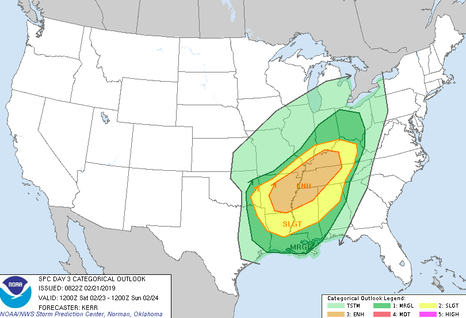
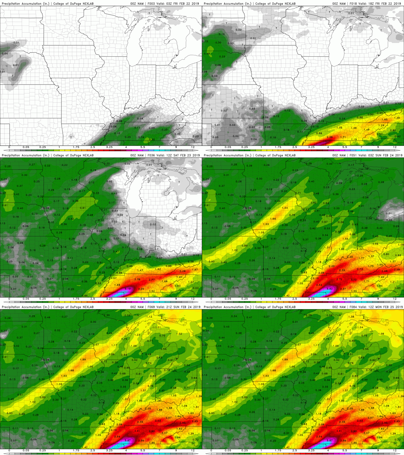
Good evening! To start, don't forget those umbrellas and rain jackets out the door in the morning. I'm sure if you forget, the rain on your way out the door will remind you anyway. As for the outlook Friday and for the weekend, its another wet, gloomy few days. It is important to note we are under a FLOOD WATCH until February 23 at 7am. On the bright side, next week looks to be mostly clear and SUNNY with high's in the 50's. So before we get to next week, lets discuss what will be happening over the next few days and namely, the next 24-36 hours. This graphic was produced today by the NWS (National Weather Service) with regard to the up and coming system moving in Saturday (Day 3 Outlook). For east TN, we are mainly under a Marginal risk with the far western portions of east TN bordering the slight risk. Basically, this means heavy rains as well as thunderstorms are expected with this system. The risk of tornadoes and hail is possible but not likely. The set up for this system is quit challenging due to its timing and location. Luckily, the bulk of severe weather will stay to southwestern TN, northern Mississippi, and eastern Arkansas. Lots of moisture from the gulf will funnel in combined with the convergence (or coming together) of the sub-tropical jet and a southern "chunk" of the polar jet. This will cause lots of vorticity (spinning), energy, and moisture (from the Gulf) to supply the system. For the areas described above, (north Mississippi, eastern Arkansas, and southwestern TN) tornadoes, heavy winds, and lots of rain is on the medium end of likeliness. As I said though, this system will phase out (weaken) by the time it reaches the east TN area. Be advised this system will still contain the possibility of heavy rains, winds, and thunder (at times). To clear any confusion, the more severe threat (heavier rains, thunder, and winds) is expected to occur Saturday afternoon/evening. As for Friday, expect heavier rains at times embedded with thunderstorms, along with heavier winds at times. As seen above, heavy rains from late tonight/early Friday morning until late Saturday will bring total rainfall of 2-2.5 inches. Portions of the far western parts of east TN could receive more. Once this system moves out late Saturday night, expect the sun to return and temperatures to be comfortable with high's in the 50's most of next week. For your daily forecasts, check out the "Weekly Forecast" tab at the top right portion of our page. Stay dry and be safe as flooding is possible over the next few days.
0 Comments
Leave a Reply. |
Your trusted source for everything weather in East Tennessee.
Social Media
|


