|
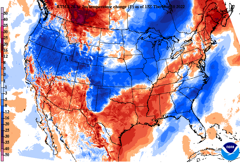
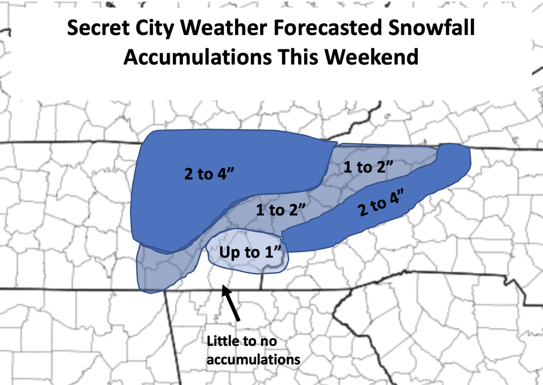
A building warm front will advect in warmer air today and tomorrow, with highs to end the work week Friday in the mid to upper 60s. Keep in mind these temperatures and the roll they will play in any snow accumulations (more info below). Looking at the past 24 hours, temperatures are around 10 degrees warmer today and that trend will continue into Friday as well. Things quickly change by Friday night, as a very strong cold front will surge through the area. This will allow for the change over to snow and provide accumulations across the area. Given the very warm surface temperatures Friday afternoon, this will likely eat into accumulations. A slushy mess is likely on the lowest layer, which could pose additional issues Saturday night into Sunday with lows dipping into the single digits and teens. High pressure fills in Sunday, warming temperature back up to end the weekend and into the new work week. Here is our rough accumulation map for Friday night into Saturday. Those living in the Plateau, especially Northern Plateau, could see locally higher amounts up to 6". For the Central Valley, generally between 1-2" is possible, with lesser odds the further south you go. If snow can hold on through Saturday, we could see an icy layer below the snow (given the expected warm surface temps initially) Sunday morning. Changes will continue to be apart of this forecast, but generally expectations are for what is mentioned above. Partly cloudy skies continue this afternoon, with sunshine to start us off Friday as well. Increased cloud cover will then follow for the later half of the day, with rain showers by the late evening then snow thereafter. Have a way to receive alerts, as I fully expect a winter weather advisory to go out for the greater part of the area. Pre-recorded for 5pm show
0 Comments
Leave a Reply. |
Your trusted source for everything weather in East Tennessee.
Social Media
|


