|
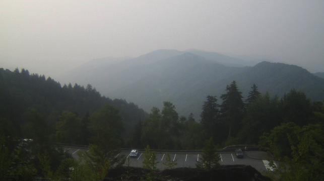
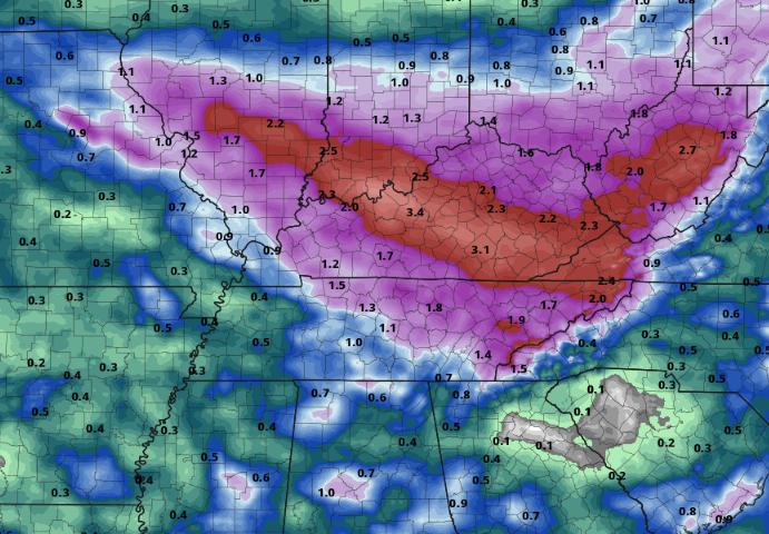
Good morning all! We are starting out on a foggy/hazy note, with this view over the Smokies at the Newfound Gap area. The good news today, hazy conditions will be on the slow decrease through the day, with clearer air in the works through the week. The bad news? Several passing disturbances will bring a flash flooding threat with a few strong storms also possible today through Friday. In terms of temperatures, we will top out in the mid and upper 80s this afternoon, which will be the theme throughout the week. Muggy conditions will only get worse towards Wednesday. So what about this flooding threat? Well, it is complicated. A strong area of high pressure is settled across the Southwest United States, which will allow for a series of disturbances to ride on the edge of the high and bring rounds of rainfall to the Tennessee and Ohio Valleys this week. A cold front is also dropping south, stalling out across Kentucky into midweek. As it does so, warm and moisture rich air will be pumped in from the Gulf. With clusters of storms more defined on small scale details, models are having trouble pinpointing exact timing, strength, and duration of precipitation (at least beyond Tuesday night). As such, giving exact rainfall amounts will be a challenge. Nonetheless, here is a best guess as of this morning, with 1-3" possible across East Tennessee. Keep in mind, if storm tracks change, are slower, strong storms occur, or locations see repeated activity, amounts can largely change (for better or worse). Keep your safety in mind through the week, as flash flooding potential will grow by the day. Here is a *general* depiction of how things could play out. A cluster of storms is moving through Kentucky now, which could bring some showers or storms to some along the border (north). Redevelopment will occur this afternoon, bringing a scattered shower/storm chances for those primarily along and north of Interstate 40 into tonight. Activity will begin to dwindle late in the night, with additional development mainly tomorrow evening and into the night. This second round (tomorrow) night will pose the best risk of the two day span for heavy rainfall rates. A few strong storms, posing gusty winds and some hail, will also be something to keep in mind too. A third round then follows Wednesday, before the cold front begins sliding through and a last round of showers/storms comes Thursday into Friday. The weekend generally looks a bit drier and cooler overall. With uncertainty in the finer scale storm details, be sure to check back in throughout the work week and follow along on our Twitter and Facebook. Forewarning, we will be off starting Thursday and through much of next week with website posts (here) but we will remain very active on social media. Pre-recorded for 5pm weather broadcast
0 Comments
Leave a Reply. |
Your trusted source for everything weather in East Tennessee.
Social Media
|


