|
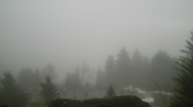
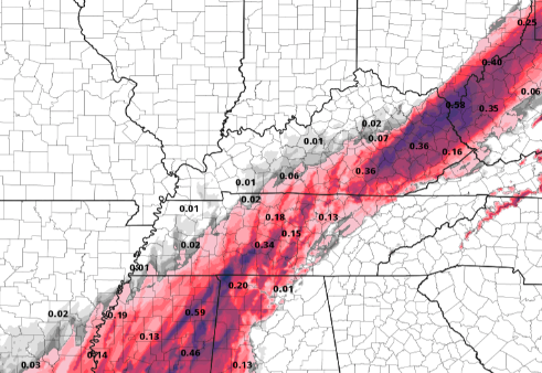
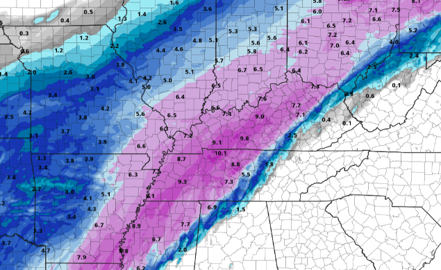
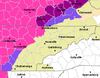
Happy Valentines Day to everyone! We have a messy slate of weather ahead. Current conditions for the valley are cloudy skies and temperatures in the upper 30's. Areas of the Plateau are seeing some light rain & freezing rain conditions. Use caution if you plan to be out on the roadways (in these areas) this afternoon. Slick spots are likely and will continue to worsen overnight tonight through Tuesday morning. A live look from Newfound Gap gives us fog and temperatures in the mid 40's. This week will give us several rounds of active weather. For starters, scattered rain to freezing rain will impact the western half of East Tennessee today and early Monday. Areas of concern will be the Plateau and northern East TN. As you can see below, salmon (freezing rain) and purple (sleet) colors dominate much of the concern locations. An Arctic air mass sits to the north and west while a warmer air mass sits across the eastern half of the state. What does this mean early this week? Well in short, a mix of weather conditions. For far Western Tennessee & Kentucky, heavy snowfall is expected tonight through Tuesday. Just to the east, Middle TN and Eastern KY can expect a mix of freezing rain, sleet, and snow. The remainder of us will see mostly rain with mixed precipitation possible. Several rounds impact the region now through Tuesday morning before we briefly dry out Wednesday. This will be followed by yet another wintry system (similar to this one) later in the week. Breaking this down on a precipitation type basis, you can see the major concern areas. The image on the left depicts freezing rain potential. Freezing rain up to 0.2 inches will be possible overnight tonight and into Monday. Power outages, slick roads, and downed trees will all be a concern. If possible, please stay off roadways and prepare as if power outages are likely. 0.25" of ice can add upwards of 500 pounds to a single stretch of power line. Following the freezing rain to sleet, snowfall moves in the second half of Monday and into Tuesday morning. Snow totals, for our covered areas, will generally be between 1 and 3 inches. Totals increase as you work west. So what about the heart of East Tennessee? We steer clear (for the most part) of hazardous weather. Freezing rain will be something of a concern, but with pavement temperatures on the warm side, this may be challenging (good news). All in all, rain will be the dominate precipitation type for Eastern Tennessee now through Tuesday. The graphic below highlights areas of watches, warnings, and special weather statements. Colors break down as: Pink: Winter Storm Warning Purple: Winter Weather Advisory Magenta: Ice Storm Warning (Kentucky) Continue to check in on Twitter & Facebook for the latest updates. The slightest shift could bring very hazardous weather across our neck of the woods. Have a good one, be safe, stay warm, and avoid travel (if possible) to Kentucky and Middle/Western Tennessee.
0 Comments
Leave a Reply. |
Your trusted source for everything weather in East Tennessee.
Social Media
|


