|
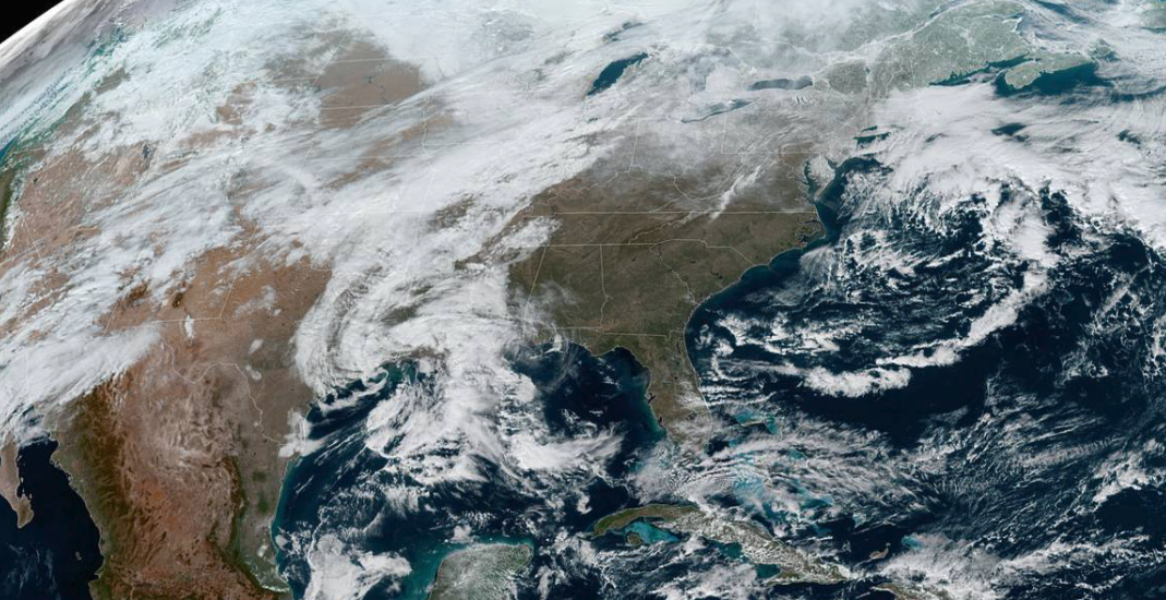
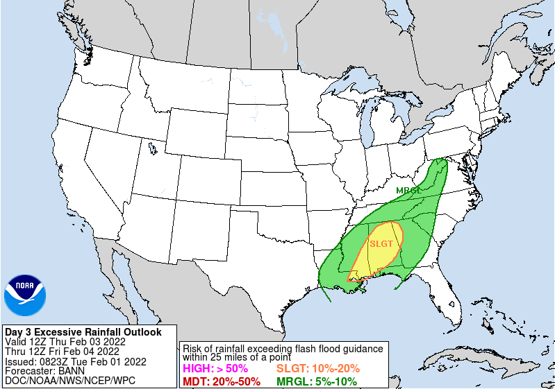
Good afternoon! The current satellite image shows beautiful sunny skies across the far Southeast right now (1 pm). This will unfortunately all change over the next 24 hours as a powerful system is expected to track across the Eastern CONUS. Highs today will be WARM, topping out in the mid and upper 50s, with some in the lower 60s. Breaking down our next weather maker, rain showers will arrive the later half of the day tomorrow. Some could see them through the morning, but all will see them by the evening. These will be on and off tomorrow and into the day Thursday, before a strong cold front slides in late Thursday. As it does so, a transition over to frozen precipitation will occur. The biggest threats here are the freezing rain potential. Areas most likely to see freezing rain, sleet, and brief snow are the Plateau and northern valley bordering KY. Going a bit more in depth: As cold air fills in at the surface, warmer air will still be present aloft. This could cause some freezing rain to form at the surface. Those most prone are the higher elevations (plateau) where cold air finds its way in quicker and the northern valley closer to the overrunning cold air surge. This transition will begin taking place in the overnight Thursday and early morning hours Friday. Freezing rain potential looks to be up to 0.1" but with warm surface temperatures leading up to the event, I anticipate more in the range of a few 1/100ths. Even so, this could provide travel impacts Friday morning. There still remains uncertainty on how quick this transition takes place, the exact track and placement of the low, and the finer details, so be sure to tune back in for further updates. The valley, for now, should fair with mostly rain and a brief transition late. Again, given the very warm surface temperatures expected leading up to the event, this should help chip away any freezing rain potential in these locations. The WPC has highlighted a marginal risk for Flash Flooding. This threat comes mainly on Thursday and into early Friday. Heavy rain and even the potential for lightning & gusty winds is possible. Have a way to receive alerts for watches or warnings leading up, and use caution if you are in flood prone areas or near water bodies. Rainfall totals look to be in the 1-2" range with locally higher amounts possible. We are also eyeing a chance for another system late weekend. Lots of uncertainty remains in the track of this, but a chance for rain and snow is not entirely ruled out. For now, prepare for quite a bit of rainfall tomorrow through Friday. Don't forget to send us reports as well as this helps others know what/where to avoid, and this also gives the NWS a heads up on warning activation (if needed). Pre-recorded for 5pm show
0 Comments
Leave a Reply. |
Your trusted source for everything weather in East Tennessee.
Social Media
|


