|
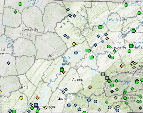
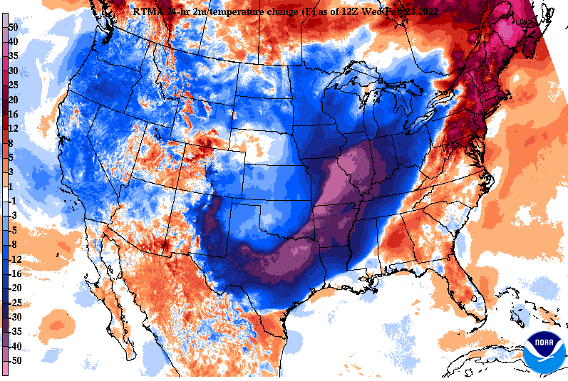
Good morning! After heavy rainfall, things are beginning to quiet down. The last of showers are along the Smokies and should exit over the next couple of hours. For those who don't follow us on Twitter/Facebook, one: you should and two: we picked up between 2 and 3" from Tuesday morning to this morning. As a result, there have been many reports of flooded creeks, low crossing areas, and river floods. Looking at the map below, oranges signify flooding, while yellows indicate soon to be flooded water bodies. Use caution, share reports, and prepare for some more rainfall in the days ahead. Looking at the play by play, a warm front will build north bringing showers late tonight and Thursday morning. This will be followed by a lull in activity and then followed with moderate to heavy showers tomorrow night and into early Friday. Overall, another 1-2" is possible, with the southeast seeing the least and the Plateau and northern Valley seeing the most. Saturday will bring the return of drier and cooler conditions before another system brings a renewed (but lesser) chance of rain. A quick look at the temperature change, the cold front will pour in cooler air today. Most will top out early with highs in the upper 50s to low 60s. Warmer air returns tomorrow, before another blast of cooler air Friday and into the weekend. A few could even see a few isolated snowflakes Saturday into Sunday (higher elevations). With ongoing river flooding and more rainfall on the way, I anticipate added issues. Luckily, this next round will impact Kentucky much more than us, allowing for waters to recede a bit. Nonetheless, have a way to receive watches and warnings, as saturated soils will likely bring more ponding to roadways, higher rivers/water bodies, and localized flooding/flash flooding. Pre-recorded for 5pm show
0 Comments
Leave a Reply. |
Your trusted source for everything weather in East Tennessee.
Social Media
|


