|
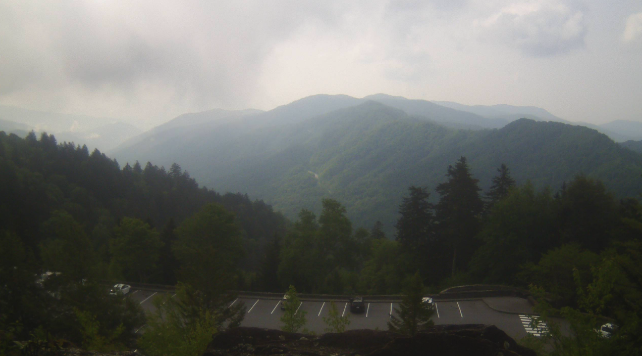
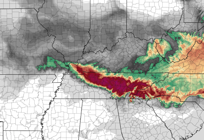
Here is a test: Find a ridge or object that is typically several miles out and ask yourself if it looks abnormally hard to see/hazy. The answer is likely yes, and the reason? Smoke from Canada. Looking at the Smokies below, the name is very fitting. As you can see, very "smoky" or hazy views are present and will be all day. Looking at a smoke dispersion model, dense smoke looks likely into this afternoon, which could impact those who are sensitive health-wise as well as visibilities. We should begin to clear out through Wednesday, with rain back in the forecast. Temperatures today could be affected by the smoke, where reduced highs in the mid 80s seem favorable. Large wildfires in Canada are the cause of what we are seeing/experiencing today. Looking at our next opportunity for rain, a slow moving cold front dips south tonight. As it does so, cloud cover will increase late and scattered showers will eventually result for Wednesday. A few storms also can't be ruled out. Unfortunately, not everyone will see rain and if they do, not in large numbers. The highest amounts will be across the Northern Valley/Plateau border KY and across the far northeast. Chances in rain and amounts decrease the further south and west you are. Nonetheless, this will be a helpful rain to our increased drought, but not something to sustain us very long. By Thursday, a cooler and drier airmass fills in. This will leave us mostly sunny and dry Thursday through Saturday, before better shower chances return Sunday into early next week. Take a look at our video forecast below for more information as well as examples of the smoke across the region. Pre-recorded for 5pm rather broadcast
0 Comments
Leave a Reply. |
Your trusted source for everything weather in East Tennessee.
Social Media
|


