|
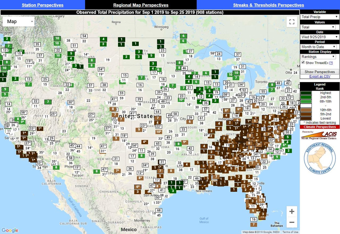
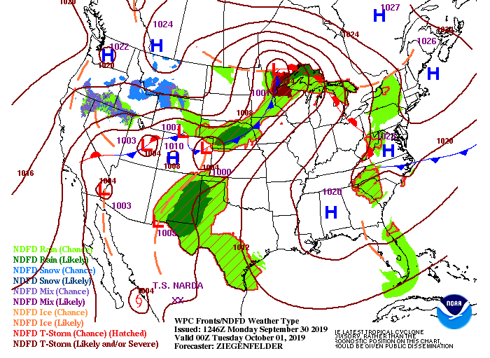
Very warm start to the work week with high's this afternoon expected to be in the low to mid 90's. Below is a map of total precipitation from September 1- 25th across the US. As you can see, very dry for the southeast with only 1 to 3 days of rainfall recorded. For Knoxville, we did not receive any rain in a 25 day period. With these very dry conditions, the drought monitor continues to worsen across the state. Moderate drought through much of the state has led to burn bans from emergency management officials, so check with your county before burning trash, open campfires, etc. These drought conditions will only get worse the next week or so, as hot temperatures, dry conditions, and little to no rainfall is expected the next 5 days. If you have been keeping up with us on social media, we showed the blizzard conditions through Montana and the Rockies this past weekend. This system will continue pushing eastward allowing for much cooler temperatures to arrive here by the end of the work week. Until then, a high pressure system will keep us warm, muggy, and dry. Little to discuss on the latest model guidance, as the high pressure system will keep things mostly sunny and warm through mid week. An isolated shower can't be ruled out this afternoon, but these will be limited to the higher elevations. Stay cool the first half of the week, as we will have high's stay in the low to mid 90's and heat indices near 100. Keep in mind your heat safety and stay hydrated if you are to be outdoors for extended periods of time. There is a "light at the end of the tunnel", so be patient for cooler temperatures toward the end of the week and into the weekend.
0 Comments
Leave a Reply. |
Your trusted source for everything weather in East Tennessee.
Social Media
|


