|
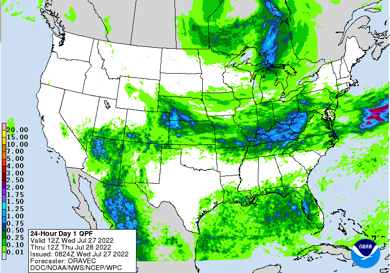
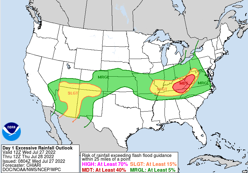
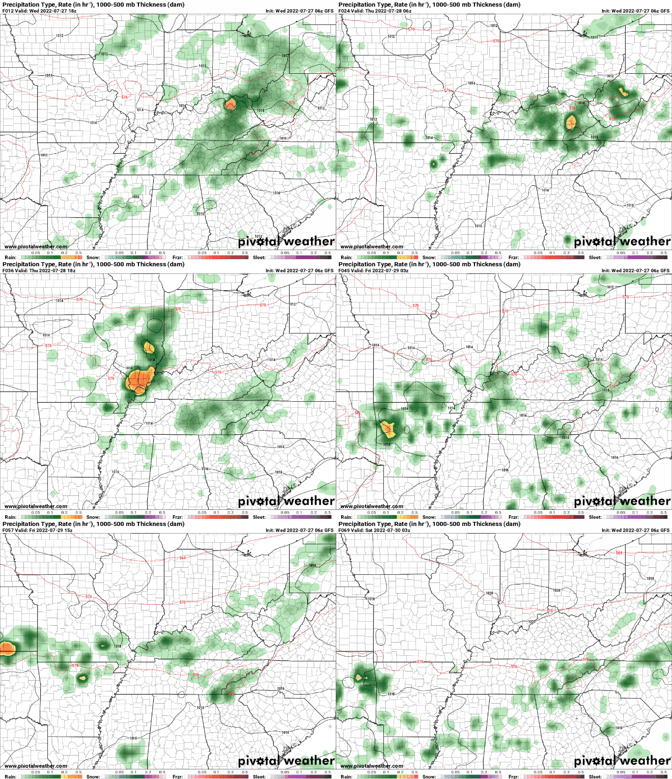
Storms will again impact portions of the area today, as a wavering frontal boundary sits to our north. Based on the Weather Prediction Centers rainfall outlook, northern counties bordering KY could pick up near an inch or more today. Locations south will primary be cloudy, but a few shower/storms can't be ruled out. The NWS in Morristown has issued a flood watch for portions of East Tennessee today (view our video forecast below for more details). The WPC has included a Moderate (3/4) risk for flash flooding today as well. This mainly outlines counties bordering KY, but a slight risk remains for the remainder of the area. I anticipate the flash flooding threat to continue to work further south and in higher categories ( slight to moderate) Friday and into the weekend. Looking into the future, the frontal boundary will dip southward, bringing renewed opportunities for heavy downpours later tomorrow. A secondary front will also work in, bringing continued activity Friday and throughout the weekend. Based on the latest guidance, this front could set up shop across portions of Tennessee, bringing rounds of showers and thunderstorms as far as into early next week or beyond. This will depend on how far south this works before stalling out. This is all to say, get used to cloud cover and periodical shower/storms, as they look to be in the forecast for the next several days. With rounds of showers and storms, flooding will remain a big concern. This is particularly so starting late tomorrow and throughout the weekend (East TN-wide). Areas that see persistent or repeated activity will have the highest risk. Have a way to receive warnings if they were to be issued. Pre-recorded for 5pm weather broadcast
0 Comments
Leave a Reply. |
Your trusted source for everything weather in East Tennessee.
Social Media
|


