|
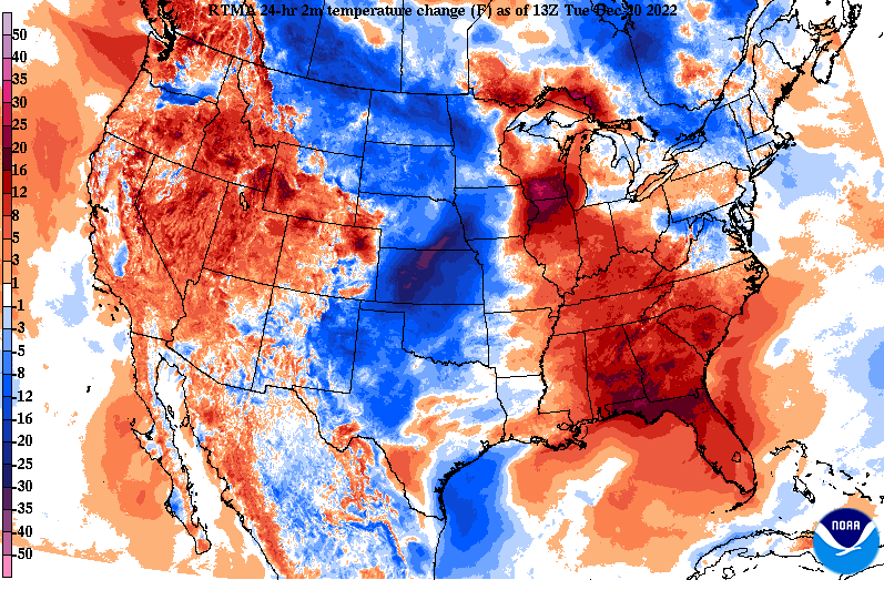
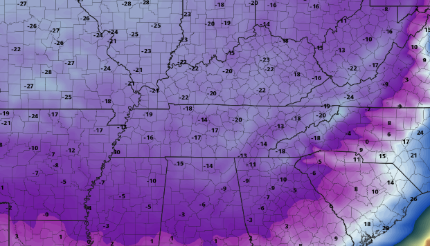
It may have felt chilly this morning, but in actuality it was warmer than 24-hours ago. Cloud cover is thinning out across the area, which will allow for partly cloudy skies this afternoon and mostly clear skies tonight. As you might expect from the warming trends seen below, afternoon highs will be warmer than yesterday, with most in the upper 40s. Pushing ahead, the biggest concern will remain the dangerously cold wind chills and icy road conditions into Friday and Friday night. Looking below, guidance is on track where we could see wind chill readings of -5 to -10, with some locations up to -20. This will be the coldest airmass across the region for the holiday weekend in several decades. Take precautions now to prepare for the extreme cold coming. The coldest night will be Friday night into Saturday, but temperatures won't feel great for most through at least early next week. Breaking down model guidance, things generally remain on track. A powerful storm system will glide east, bringing increasing rain chances through Thursday, before an arctic cold front allows for the change over to snow Thursday night. Temperatures will plummet 30+ degrees during this time, where a flash freeze could be possible. Outside of any snow alone, this will cause problems for any travel conditions, so begin planning ahead for these impacts/delays now. As far as snow chances, our forecast yesterday remains on track. A trace (the site of snowflakes) up to a few tenths remain possible in the valley. The least potential will be in the southern valley, while chances for accumulations grow the further north you go. As far as the Plateau and foothills, generally a few tenths to less than 3" is expected depending on elevation. Higher resolution data is starting to ingest this system, so we will have an even better idea of things this time tomorrow. For now, expect impacts to local commute. Icing will be the largest concern, but light snow accumulations for some also remain possible. Lastly, dangerously cold wind chills of sub-zero are more than likely Friday through Saturday night, so plan ahead for all of these concerns. We will have even more details tomorrow, so check back in. The Christmas forecast will generally be dry (other than maybe a flurry or two), with temperatures in the mid and upper 20s for the afternoon. Pre-recorded for 5pm weather broadcast
0 Comments
Leave a Reply. |
Your trusted source for everything weather in East Tennessee.
Social Media
|


