|
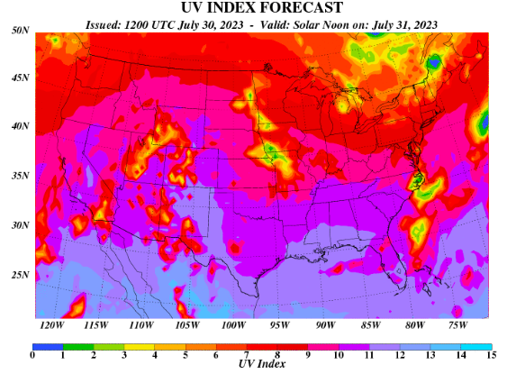
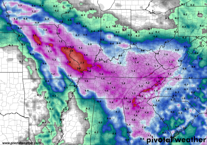
I hope you are having a good Monday thus far! I am sorry for the lack of posts this past week, as I was off enjoying the sunshine in Florida. That said, I hope you followed along on social media (Twitter & Facebook) as it was a rather active week at times. Moving forward, another unsettled pattern unfolds towards the weekend, while plenty of sunshine finds us through tomorrow. Looking at the UV Index below, we are in the "very high" category. Be sure to have the sunscreen ready if planning to be out and about for an extended period of time today and tomorrow. Cloud cover and shower chances begin moving back in Wednesday through Friday. Speaking of those shower/storm chances, how much rainfall are we talking. As of now, 0.75-1.75" is a fair guess, but that will depend on thunderstorms and where activity tracks. Those that experience stronger and/or repeated activity will favor higher amounts, while those elsewhere can expect near an inch. Overall, Wednesday night through Friday should expect a soaking rain, with cooler temperatures as well. Instances of isolated flash flooding can't be ruled out, but the dry conditions we have had yesterday, today, and for most tomorrow, should limit that potential. Looking at the break down of model guidance, most stay dry through tomorrow, though an isolated shower can't be entirely ruled out in the afternoon. Into Wednesday, shower chances will slowly increase through the day, with the best chances holding off until Thursday. Lingering activity will hold on into Friday, followed by our usual summertime shower or storm chances (in the afternoon) through the weekend. Temperatures will also warm back up to the 90 mark Saturday and Sunday. As far as the shower and storm chances (best Thursday), a few strong storms containing gusty winds or hail are possible. The severe threat, as of now, is low but not something to rule out as usual during the warm season. Other than the sunshine, temperatures should be near average today and Tuesday. Take advantage of the pleasant conditions, before unsettled weather returns Wednesday and through the end of the week. Don't forget to check out our video forecast below as well. Pre-recorded for 5pm weather broadcast
0 Comments
Leave a Reply. |
Your trusted source for everything weather in East Tennessee.
Social Media
|


