|
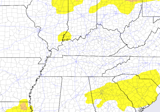
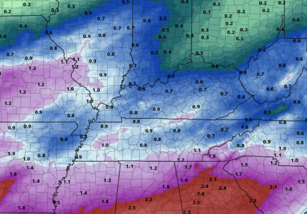
We'll start it off with good news! The latest drought index across the state remains consistent to last weeks outlook at normal conditions. I anticipate this to continue as another soaking rain arrives tomorrow and again mid to late next week. The CPC also suggests above average precipitation to close out April and enter early May. As for the day today, clear skies start but cloud cover migrates in as a system to our south works north and east across the Mississippi and Ohio Valleys. Highs today will continue to increase from yesterday, topping out in the mid 60s. With a low developing in Texas late yesterday, it will progress north and east today. This will increase the cloud cover this afternoon and lead to showers late tonight and into much of Saturday. For the most part, this will be a moderate soaking but heavy showers and a few isolated thunderstorms are possible (specifically the second half of the day). By Sunday, clearer skies work back in as high pressure approaches from the upper Midwest. This will keep things sunny and warming by early next week with highs in the low to mid 80s Tuesday and Wednesday. Looking at QPF (quantitative precipitation forecast AKA estimated forecast rainfall totals), the bulk of heavy rainfall has dipped a bit further south than yesterday's forecast, but still leaves upwards of an inch and a half for south East Tennessee. Across the Valley, upwards of an inch are likely before drying back out Sunday afternoon. That will do it for the week...I hope everyone has a wonderful weekend! Showers will fulfill much of Saturday, making Sunday the best day of the weekend. We will also see more normal temperatures Sunday afternoon with above average highs early to mid next week. Last note: we did break the low record for Chattanooga (previously 33) and Knoxville (previously 31) for yesterday morning. Pre-recorded for 5pm show
0 Comments
Leave a Reply. |
Your trusted source for everything weather in East Tennessee.
Social Media
|


