|
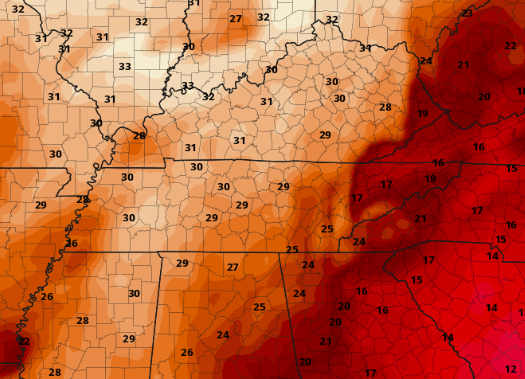
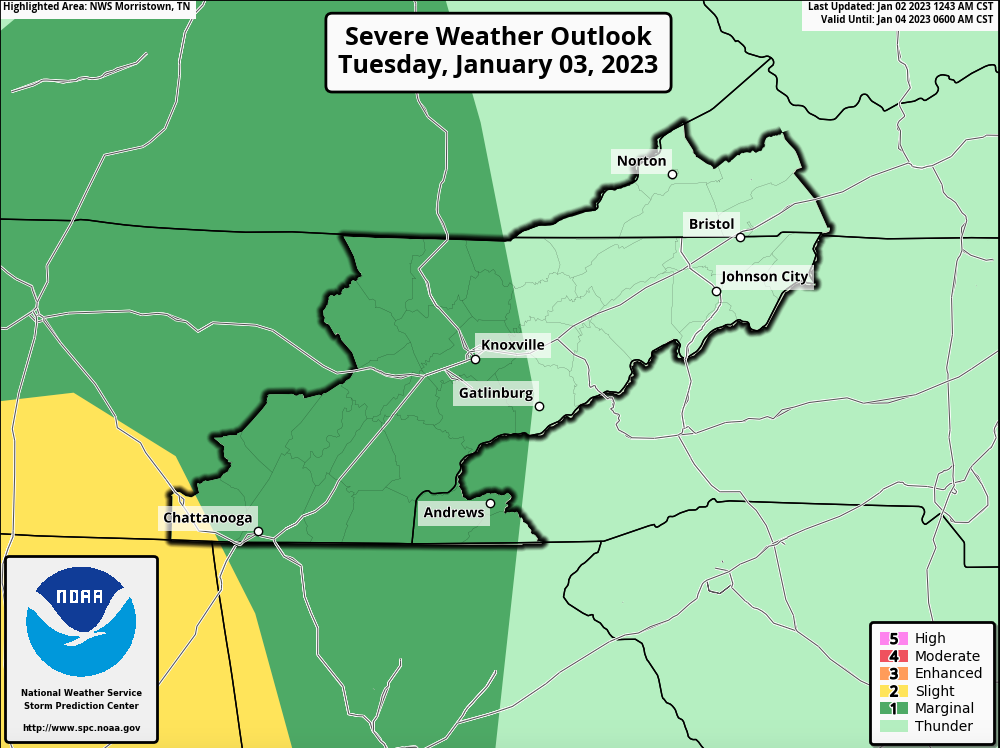
Happy New Year! We have kicked off under well above average temperatures, with tomorrow shaping up to be the warmest of the stretch. Highs will range from the mid to upper 60s tomorrow, which is 20+ degrees above average. This will also set the stage for showers and thunderstorms before a dip back to near average temps late week. Examining the latest excessive rainfall outlook, WPC has placed much of the area under a Slight risk. This means there is at least a 15% chance of flash flooding tomorrow, with the best chance during the afternoon to early evening timeframe and primarily within thunderstorms. Overall this system is fairly progressive but given the nature of thunderstorm potential, isolated flash flooding issues will be something to keep in mind. Heavy rainfall rates of an inch or more per hour will be possible within storms and could create these hazards. The good news is this system is this system won't be hanging around long, and drier conditions find their way back in Wednesday. In addition to the flash flooding threat, there is a low end threat of severe storms as well. The best potential is across the southern valley, but all could see the chance for a severe storm or two (risks are low). Damaging wind gusts are the primary threat here, with again the best timing for this during the afternoon and evening Tuesday. The overall break down of this system will be a few isolated showers overnight (otherwise cloudy), with much of the same through Tuesday morning. By the early afternoon, showers/storms will be inching in off the Plateau and working across East Tennessee through the remainder of the day. Activity will begin diminishing from west to east into Tuesday night, where activity exits east mid morning Wednesday. Clearer and cooler conditions follow, with sunshine and highs in the 40s to near 50 Thursday and Friday. Pre-recorded for 5pm weather broadcast
0 Comments
Leave a Reply. |
Your trusted source for everything weather in East Tennessee.
Social Media
|


