|
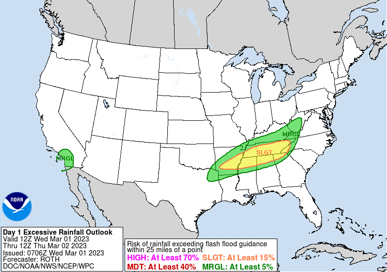
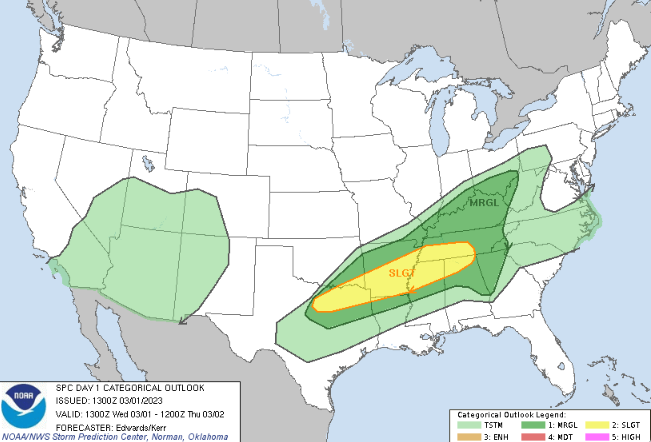
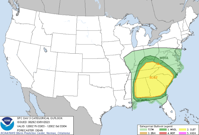
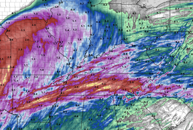
A busy few days are ahead, so let's jump into it. Today will feature increasing clouds, where showers and storms arrive ahead of an approaching cold front this evening and overnight. Some storms could be strong to severe while also posing a flash flood/flood threat. Taking a look below, a Marginal risk of severe storms and a Slight risk of flash flooding is highlighted. Have a way to receive warnings if they were to be issued-- especially in the overnight hours. Highs today will be quite warm, topping out in the mid (to even a few spots upper 70s). As the cold front stalls out across the state, a secondary area of low pressure forms in the Southern Plains. This will be even stronger than the first, pulling north and passing west of the area into Friday. As it does so, a renewed threat of strong to severe storms and flash flooding/flooding will find us. Activity will dwindle into midday tomorrow, picking back up with this second low by Thursday night and through Friday. *The image below is not an official forecast, just a model* Taking a look at one of several models, looks like the axis of heavy precipitation has stayed relatively the same. With the track pretty on set with system number one (tonight), rain amounts between 1-3" look likely. That said, some guidance reflects higher amounts while others lower. This is likely a result of convection (or thunderstorms) firing up and working across overnight. Within these, higher amounts are likely whereas lower amounts outside of these heavier showers/storms. In total, 2-4+" is likely starting tonight through Friday night. That will wrap it up for today. Check out our video forecast below for more information while also hitting that follow button on Twitter & Facebook if you haven't already. Severe weather (of all types) and a hydro threat are in play at times tonight and again Thursday night through Friday; be sure you have a way to receive warnings and have an action plan prepared now. Pre-recorded for 5pm weather broadcast
0 Comments
Leave a Reply. |
Your trusted source for everything weather in East Tennessee.
Social Media
|


