|
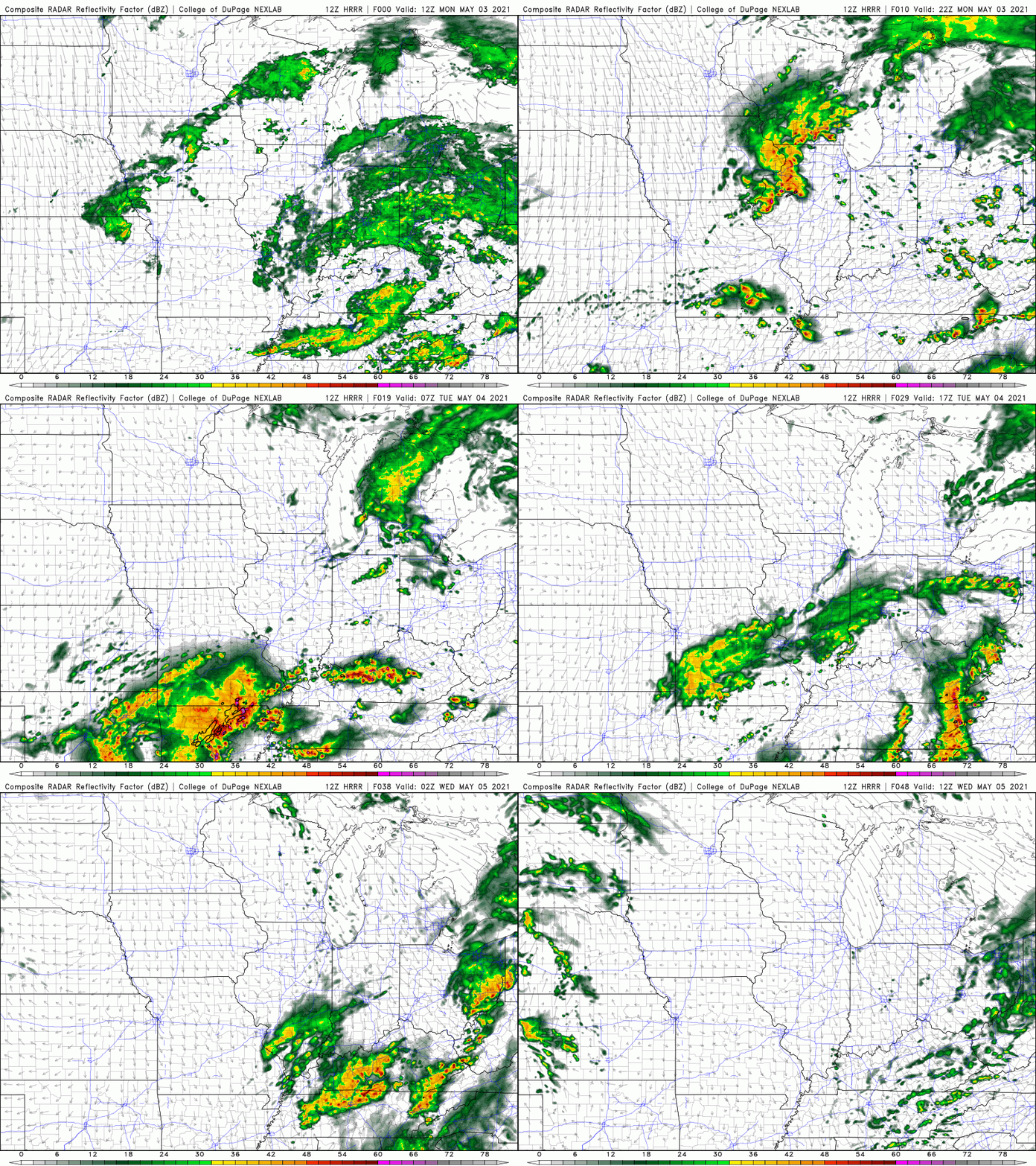
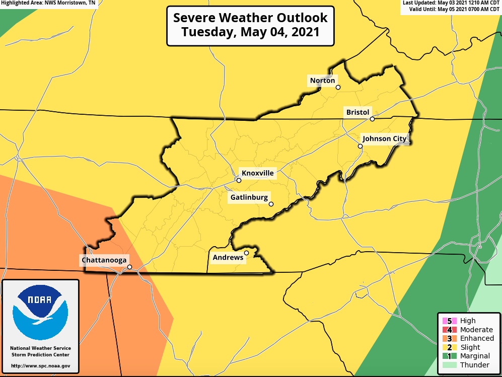
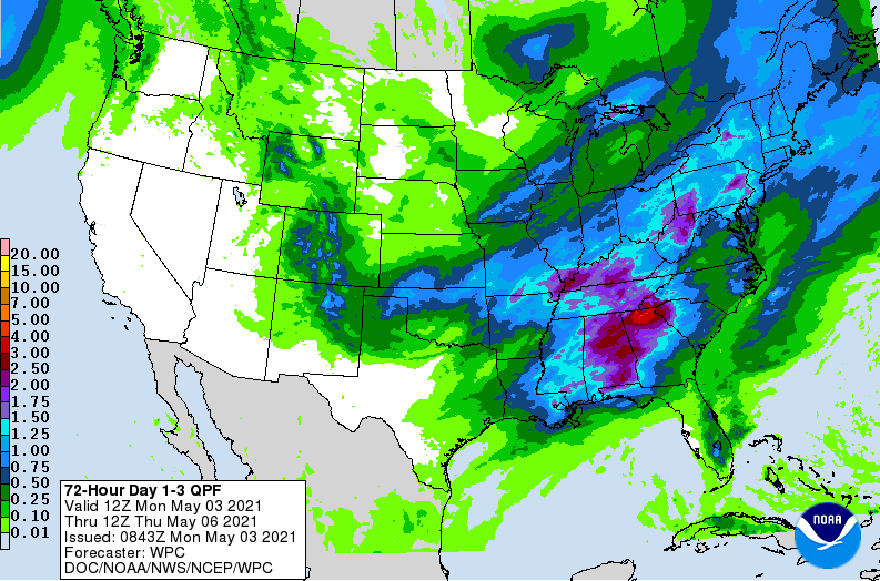
Good afternoon! Scattered showers and a few isolated storms are working through the valley early this afternoon. This trend will likely continue as a system just to our southwest works northward. We will likely see a bit of a lull towards the evening and overnight tonight, before heavy showers and storms arrive for the lunch time hours tomorrow. The timing of this falls between 9am - 1 pm. Additional showers and storms will be possible later in the afternoon, but we are expecting the strongest activity during the late morning timeframe. As you can see below, dark oranges, reds, and even purples fill the area as clusters of storms work through. To re-emphasize the potential for strong and severe storms tomorrow, the SPC has placed most of East Tennessee under a Slight (2/5). Additionally, Chattanooga is within the Enhanced (3/5) risk. The main threats through the late morning and afternoon will be damaging winds and large hail, though a few isolated tornadoes can't be ruled out. Further west under the enhanced region, damaging winds, large hail, and a few strong tornadoes will be possible. Be weather aware through the day tomorrow and have a way to receive alerts if watches and warnings are issued. Locally heavy rainfall will yet be another issue we will have to face tomorrow. A marginal risk of flash flooding is in place both today and tomorrow with a slight risk outlining our southern border. Rainfall amounts are expected to be between 1-2 inches with higher amounts (specifically across the SE) as high as 3+". Tomorrow will likely be active between the severe weather risk and flash flooding issues we could face. We'll continue to provide updates, but have a way to receive alerts from the National Weather Service and local officials. Pre-recorded for 5pm show
0 Comments
Leave a Reply. |
Your trusted source for everything weather in East Tennessee.
Social Media
|


