|
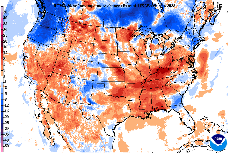
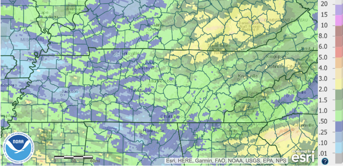
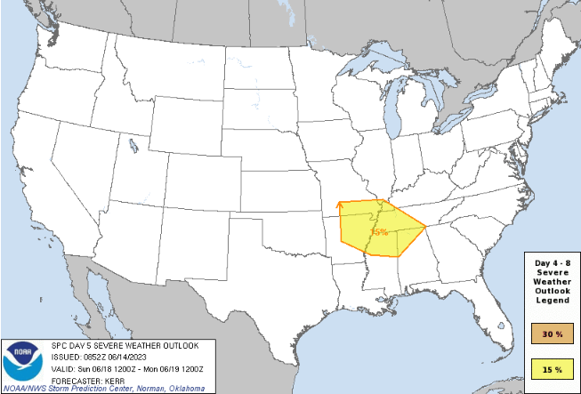
9:30 am temperatures were warmer than this time yesterday, as highlighted below, with most in the mid to upper 60s. Warmer highs will also result, with upper 70s to low 80s forecast. There will be some question on how much influence cloud cover and showers/storms could have this afternoon. Where thicker coverage will result in lower highs. Nonetheless, most should achieve this range. As for the forecast, a mix of clouds and sunshine is expected. Those furthest north will fair the best (more sunshine & lesser chance for showers) while those further south (nearer to GA/AL) will see the most cloud cover and highest chance of activity. In fact, Chattanooga has showers passing through now (9:30 am). Better weather conditions will return Thursday, where most see partly cloudy skies for the day. An isolated shower or storm will be possible both tomorrow and Friday, but low in chance. Turning focus to our most recent bout of needed rain, check out totals. Keep in mind moderate drought has developed across the heart of East Tennessee, so this rainfall was very beneficial. By the numbers, most picked up an average of 1 to 2 inches, but locally higher amounts were seen in the northern plateau, up to 3 inches. We could see another bout of heavy rainfall and/or strong storms by late weekend into early next week (follow below). An approaching low pressure system and front will allow for widespread showers and storms late weekend into next week. As we mentioned yesterday, there is still uncertainty in the timing and strength of this system, so some changes are likely. In fact, since yesterday a slower trend was noted, hence why better shower chances have been moved to Sunday & Monday versus late Saturday into Sunday. We will monitor this closely, as strong storms and heavy rainfall appear increasingly likely. Check back in with us for more details in the days to come. Conditions today are a mixed bag, with some seeing cloud cover and on and off showers, while others fair partly cloudy with more limited rainfall chances. Either way, better conditions are in store for all tomorrow through Saturday, with limited shower potential through this time. Pre-recorded for 5pm weather broadcast
0 Comments
Leave a Reply. |
Your trusted source for everything weather in East Tennessee.
Social Media
|


