|
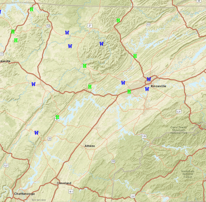
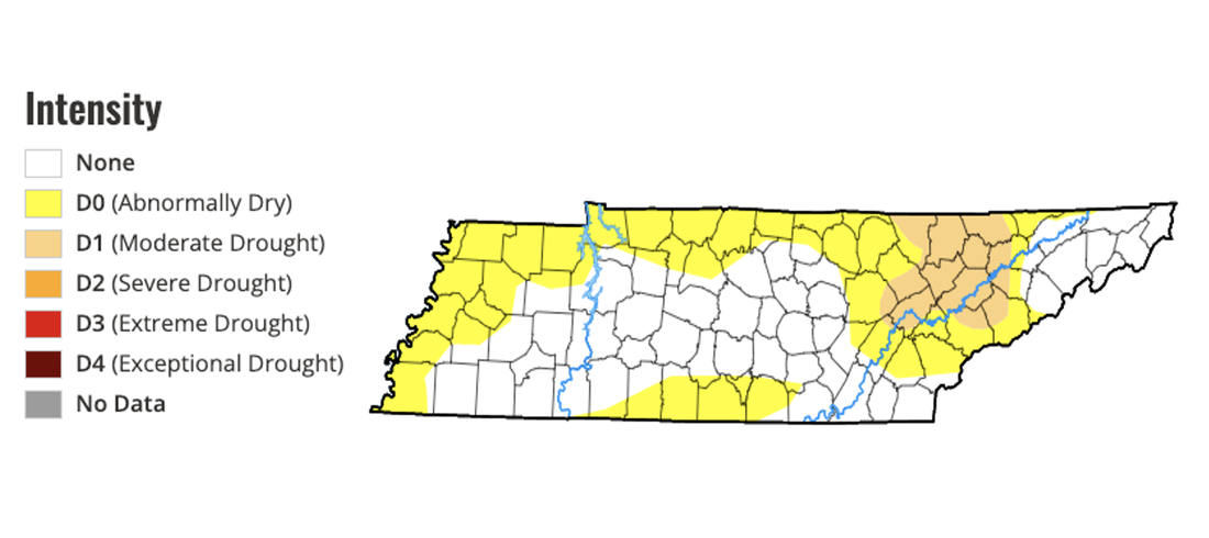
First on the plate are the storms from yesterday....most locations saw both heavy rain and strong storms at one time or another Sunday afternoon/evening and this image below depicts that. This is an unofficial review of reports at NWS Morristown, where several hail and wind damage data was submitted. Fortunately, no big threat for severe storms in the next few days, but better chances for showers and storms does appear on the horizon towards the weekend. For now, confidence is low on anything strong but something we will monitor through the week. Taking a few steps back now, check out the latest drought map across the state. Prior to yesterdays soaking rain, many were inches of rain behind when compared to 30-day norms. As a result, abnormally dry and moderate drought has popped up for portions of the state. The good, and obvious news, changes are coming ahead. Heavy and widespread rainfall yesterday has allowed for things to catch back up a bit, so I expect some improvement to this map later in the week. That said, we are still behind in rainfall numbers and will need more in order to catch back up to averages. Moving forward, a stagnant low to our north and a series of passing upper level disturbances will keep rain chances in the forecast. A weak high will press in tonight, leaving dry conditions this afternoon through the first half of the day Tuesday. Into Tuesday afternoon and evening, isolated to scattered shower/storm chances return, with a daily afternoon to evening threat planned each day this week. These will be the usual hit and miss shower/storms, with activity dissipating into the nighttime hours each day. That will wrap it up for todays forecast. Overall, it's going to be cooler today with the passing of yesterdays front. Most top out in the mid 70s, but warmer air is to come in the days ahead. We will find the mid to upper 80s by the end of the work week (Friday). Lastly, it is mostly cloudy for many now but coverage will scatter out into this afternoon, where most end up partly cloudy through the remainder of the day. Enjoy! Pre-recorded for 5pm weather broadcast
0 Comments
Leave a Reply. |
Your trusted source for everything weather in East Tennessee.
Social Media
|


