|
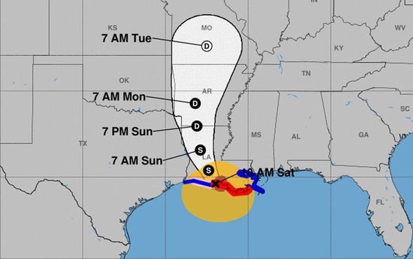
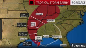
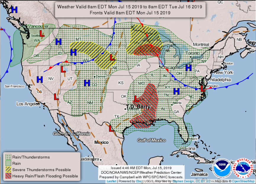
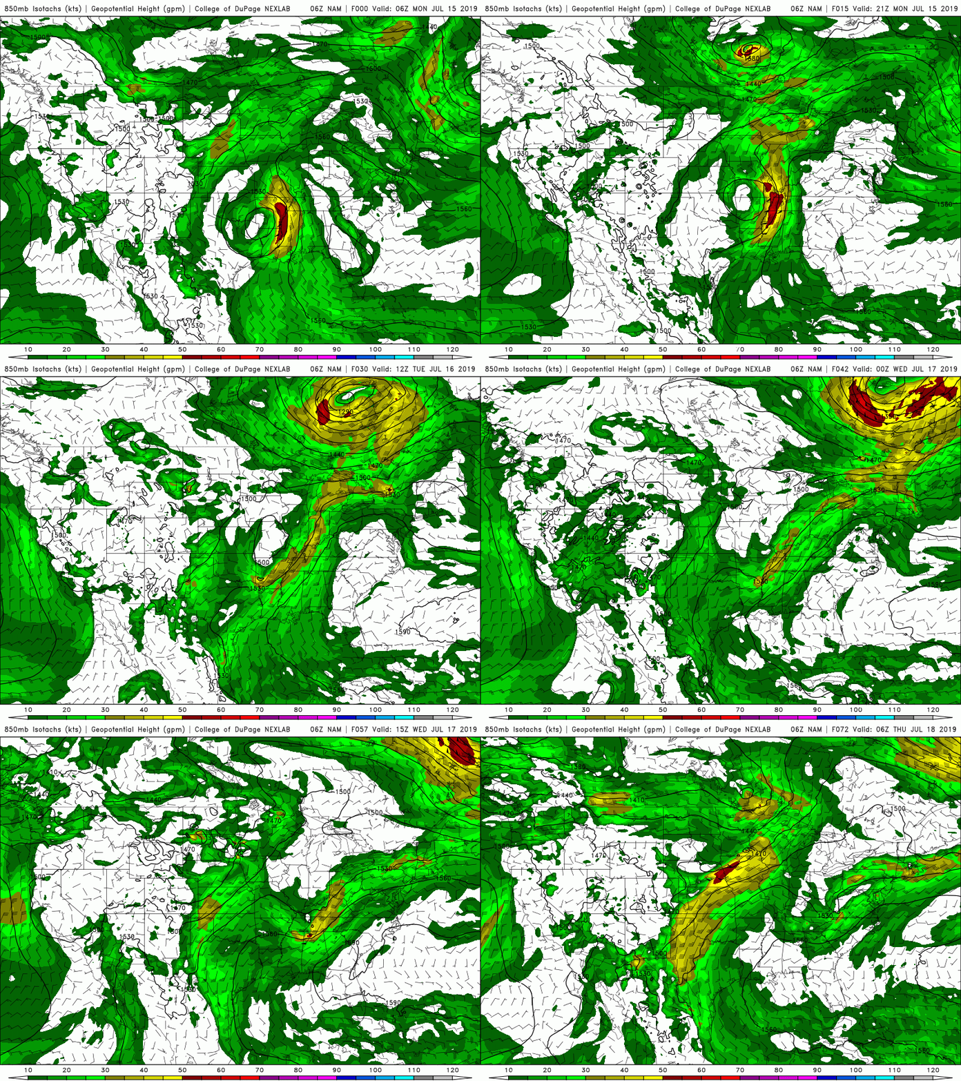
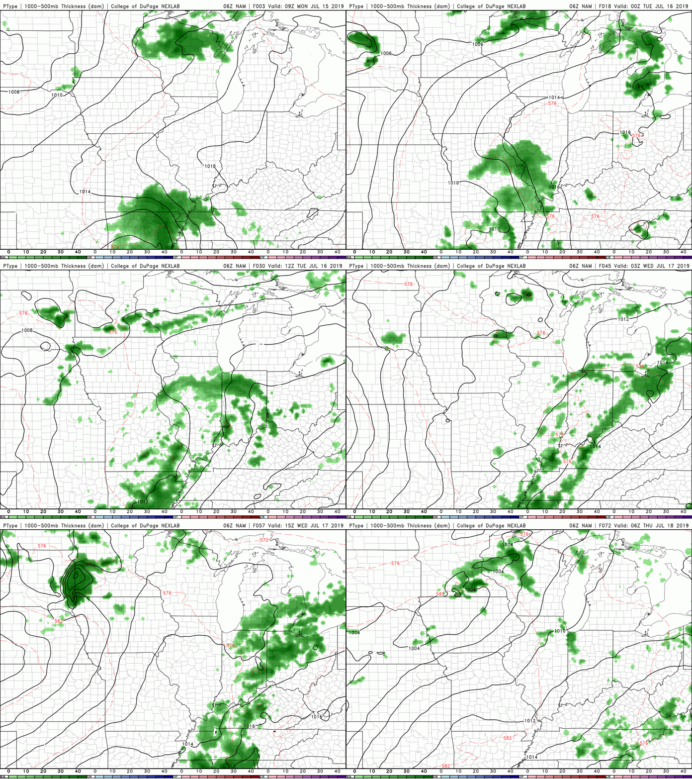
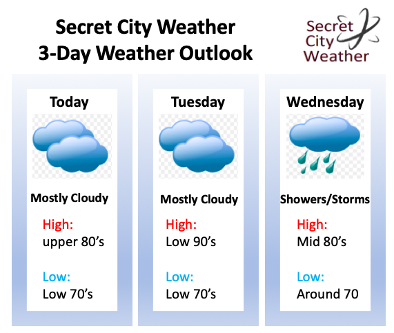
Happy July 15th and Monday to everyone! A little update on my self: I had surgery Wednesday afternoon on my jaw, but I am recovering and feeling better each day. Thank you for bearing with us here and on social media the past few days. I plan to get back on schedule today with everything. So onto the weather.... It has been a big topic in the weather and news world since late last week, Barry. As of right now, "Barry" is predicted to take a more westwardly path than previous anticipated. I will explain the reasons why and how that will effect us more below, but because of this new "path", you can expect less precipitation than anticipated. Last week I was calling between 1-4 inches of rain through Thursday of this week, but with more westwardly movement, I am calling for rain totals up to an inch and a half. This is open for interpretation because our western counties will receive more rainfall than our far eastern counties. Nonetheless, up to 1.5 inches of total rainfall through Thursday is a good average for the eastern portion of the state. This weekend we will see residual rain bands move through the area associated with this trough. Being a full 6 days out, it is hard to pinpoint how much addition rainfall we could see this weekend, so up to half an inch is a safe bet for now. As I briefly touched on above, the path of former hurricane Barry has moved more westward. The reason? Due to an upper atmospheric pattern currently residing over the United States. Taking a look at the current forecasting map (bottom right) you can see a "L" (representing a low) between two "H's" (representing high's). This low has become engulfed between these high pressure systems and has funneled more westwardly. Think of a high pressure system as a wall of traffic and the "low" as a car trying to drive in this traffic jam. In this case, the "space" is more westward in between the high's, which is what is taking place. The bottom left graphic (an older image) was shown to represent the full cycle of this low. I am sure many of you remember the shortwaves and afternoon popup storms we received early last week, well that was part of what morphed into hurricane Barry. Barry will eventually do a complete 360 degree turn by this week. The proposed track of the low can be seen above, but the entire cycle and path that it took over the course of a week and a half can be seen in that bottom left image. Looking ahead to the likely path of this low, we see (based on this model) for it to move north and east of our area by the end of this week. The model below is showing the 850mb level winds. We see at the beginning of the gif a "circle" with bright red colors to the east of it (strong winds). As the gif continues, this begins to weaken, move north and east, and eventually converge with another low in Canada. Moving forward into mid week (Wednesday) expect those rains chances to increase as the rain associated with this low grows closer. Barry, now known as a shortwave trough will propagate (move) north and east of Tennessee later this week and eventually out of the area by late this weekend. As I said, our highest day for precipitation will be Wednesday and the first half of the day Thursday before scattered showers finish our week. This weekend we could still see scattered showers from this propagating low, but they will be your "typical" afternoon scattered storms that we have been used to lately. Temperatures will be average, with the exception of tomorrow (Tuesday). As southern flow begins to dominate, temperatures will be cranked up into the low 90's and heat indices could feel closer to the mid/upper 90's by the afternoon. Below is the 3-day outlook describing what I said above. Mostly cloudy with a few isolated showers/storms today and tomorrow with the brunt of rain coming Wednesday and Thursday. I hope everyone has a good week and don't forget the umbrellas mid week!
0 Comments
Leave a Reply. |
Your trusted source for everything weather in East Tennessee.
Social Media
|

