|
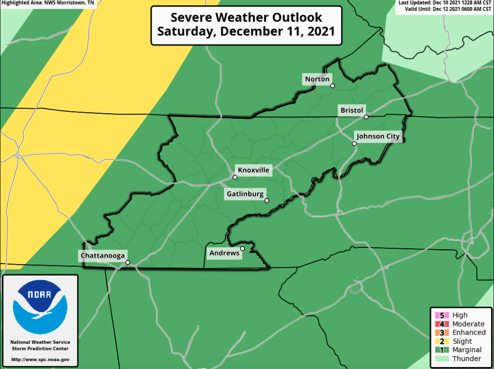
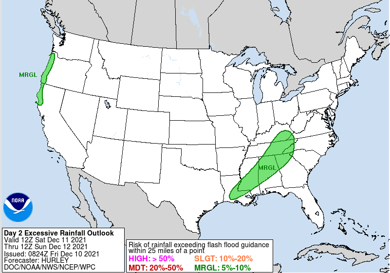
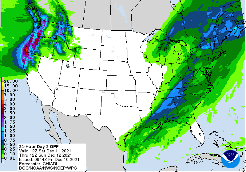
Good Friday morning to all! All eyes are on a line of showers and storms expected to develop tomorrow morning. The SPC has highlighted a "Marginal" risk for the area. The biggest hazard will be damaging wind gusts/straight line winds, but also an isolated area or two of spin up can't be entirely ruled out. Breezy conditions can be expected regardless with gusts upwards of 25 mph for valley locations. These will be a bit stronger the higher in elevation you go. Timing will generally be mid morning for the initial line, but lighter showers will continue into as late as the early evening. In addition to the severe threat, a threat of flash flooding is also possible. Heavy rain rates within a short amount of time could lead to some localized flash flooding and water rises. The WPC has highlighted a Marginal risk for this across nearly all of East Tennessee. Looking at overall rain totals, numbers remain relatively the same. Upwards of an inch of rainfall can be expected with locally higher amounts in thunderstorms and training locations. This should exit by Saturday evening, leaving cold and drier air to filter in through Sunday. Highs drop back into the upper 40s/low 50s to end the weekend, and then warm through early next week. Have a way to receive alerts....the severe threat is low but possible. Especially with the warm air, very wet environment (climatically), and strength of the front working through, winds could pose an issue. Have a good one, safe one, and don't forget to follow us on Twitter/Facebook for updates and information releases. Pre-recorded for 5pm show
0 Comments
Leave a Reply. |
Your trusted source for everything weather in East Tennessee.
Social Media
|


