|
A very breezy day is in the works, as southwesterly flow will bring gusts up to 30 mph this afternoon. Likewise, tomorrow will be very similar to even more gusty, with gusts northward of 40 mph possible. I will also mention these expectations are outside of the anticipated wind gusts within showers and thunderstorms. Not only will it be breezy today and tomorrow, but also warm. Highs today will be in the low and mid 60s with highs tomorrow near to around 70. 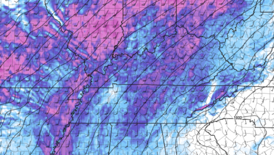 Since yesterday, the SPC has expanded the Slight risk much further east. With the later timing of this system, I anticipate a continued eastward shift. Isolated showers will start us off, but strong to severe storms along and ahead of a cold front will arrive tomorrow late afternoon (west/Plateau) to late evening/early overnight (far east). Within this line of storms, damaging wind gusts (up to 60mph), large hail, and isolated tornadoes are possible. Have a way to receive watches and warnings if they are issued and know your protected location. A flash flooding/flooding threat will also be associated with this system, as heavy rainfall is expected. 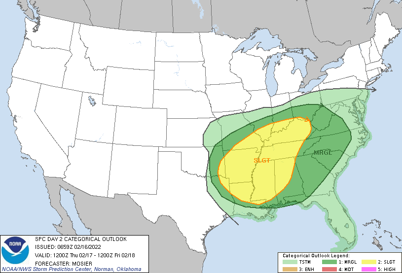 Looking at modeled guidance, here is the general run-through. Isolated showers will start us off under mainly cloudy skies. As this line takes shape and works east, strong to severe storms will be embedded within. This could allow for the development of isolated tornadoes, damaging winds, and large hail. Timing breaks down as: Middle TN/Far Western Plateau: Late afternoon/early evening (5-8pm) Central Valley: Evening to early overnight (7-10pm) Foothills and East: Late evening to the overnight (9pm-midnight)  Most activities should be fine through the day tomorrow, with the exception of wind related constraints. If you would like more information on this system, ways we can help you or your business, or even daily/weekly weather briefings, give us a shout by emailing us at [email protected] or visiting our "Contact or Services" tab above. Pre-recorded for 5pm show
0 Comments
Leave a Reply. |