|
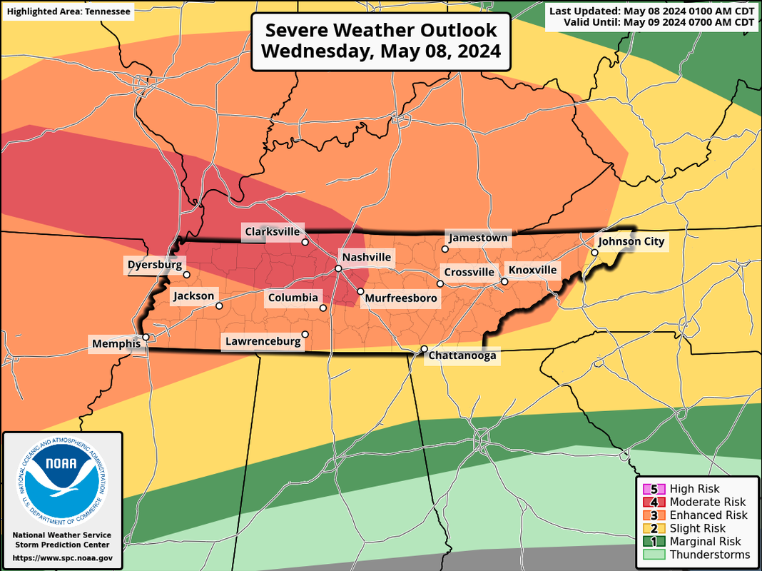
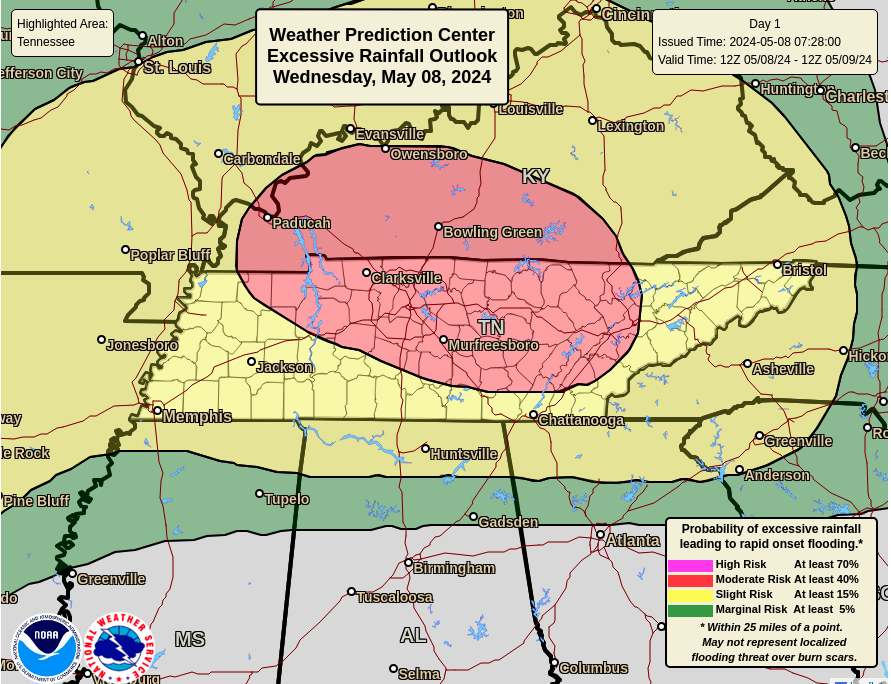
Folks, a very active weather day is in store. Showers & storms are already firing up across portions of Middle Tennessee, the plateau, and northern valley, with activity to grow with time the later half of today. An enhanced (3/5) risk for severe storms is present, with damaging wind gusts (up to 70 mph) and large hail are the main threats, but isolated to scattered tornadoes also can't be ruled out. Timing-wise: Northern Valley/Plateau: Initially this morning, but will see a "relative" pause in activity late morning to early afternoon before widespread storms return this afternoon into tonight. Central Valley: Mid morning to early afternoon initially, then widespread storms after 5 pm through the early overnight hours. Southern Valley: Some scattered chances late morning to early afternoon, but highest chances after 10 pm tonight. In addition to severe weather, significant flooding is possible. A flood watch is in effect to highlight this threat, along with a moderate (3/4) risk. With storms already bubbling up in the north and western portions of the area, further repeated activity this afternoon to tonight will add to the risk. In general, between 2-4" of rainfall is expected, but in areas of the highest storm activity, upwards of 5-7"+ can't be ruled out. Flash flooding and flooding in local water bodies will be a big concern tonight in addition to strong/severe storms. PLEASE be weather aware today, know your plan if warnings are issued, and try not to be out and about if you can help it. We have a full breakdown of expectations below, so take some time to check it out. Recorded at 8:00 am 5/8/24
0 Comments
Leave a Reply. |
Your trusted source for everything weather in East Tennessee.
Social Media
|


