|
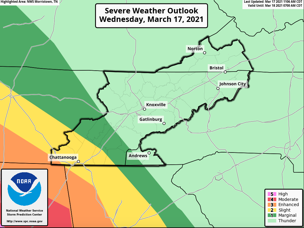
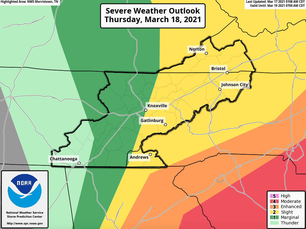
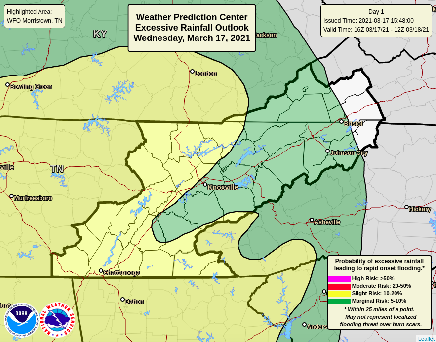
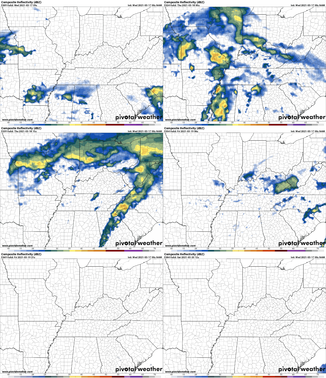
Good Wednesday afternoon! Showers are beginning to build in, working across the Plateau and Chattanooga now. This will be our first wave of the day with heavier showers and thunderstorms expected tonight and early Thursday. Looking at the Day 1 (Today, left) and Day 2 (Thursday, right) we do have some severe weather outlooks across the area. To start, Chattanooga just does miss the "Enhanced" (3/5) for severe storms, but is in the slight risk. For tomorrow, a slight risk for severe storm sits across the heart of the Valley and to the east. Expect the bulk of this to be early Thursday morning. All severe weather is on the table but the biggest risks will be hail, frequent lightning, and gusty winds. Another hazardous weather feature that needs to be highlighted is the potential for flash flooding. The Plateau and Southern Tennessee lie in the slight risk (10-20%) chance for flash flooding while the remainder of the area is under a marginal (5-10%) chance. Future radar breaks down as the following: Showers are working through now as a warm front slides through the area. As the low progresses east, heavy showers and storms will accompany bringing marginally severe storms that will include gusty winds, lightning, and hail. Isolated tornadoes can't be ruled out, but the best environment will stay contained to the south and west of the Plateau & Chattanooga. The timing for "heavier stuff" comes late tonight and early Thursday morning. Nightfall helps our cause as nighttime cooling helps weaken the storm system. On the opposite end of the spectrum, if storms maintain their strength, night hours are the worst for severe weather as many are asleep and don't receive alerts. Have a way to receive watches and warnings if they are issued tonight and Thursday morning. We plan to monitor this closely, especially from midnight onward. Be on alert through the evening hours to Thursday morning. This will be our best opportunity for heavy showers and storms. Also have a way to receive alerts if severe weather were to occur (NOAA weather radio, apps, social media, tv, etc.) Have a good one, be safe, and check in for updates on our Twitter/FB tonight. Pre-recorded for 5pm show
0 Comments
Leave a Reply. |
Your trusted source for everything weather in East Tennessee.
Social Media
|


