|
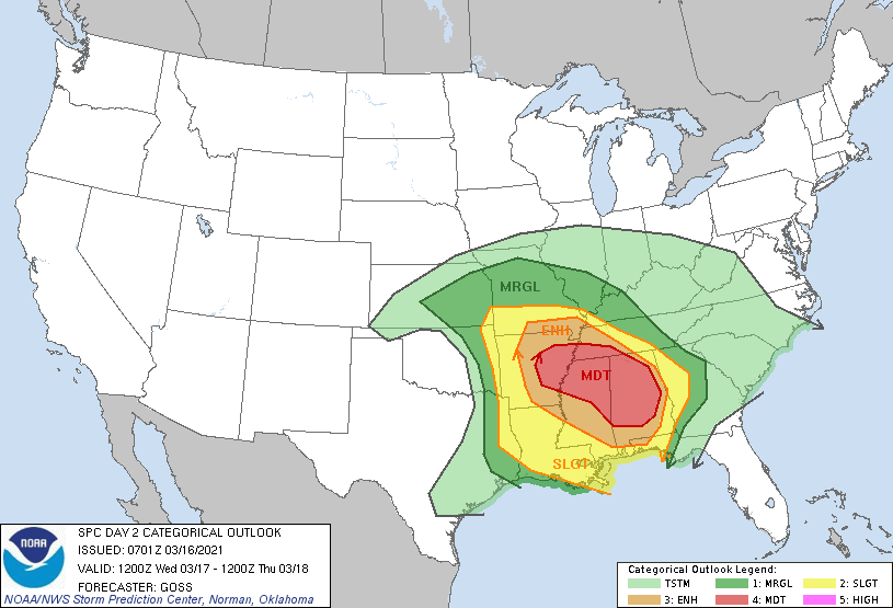
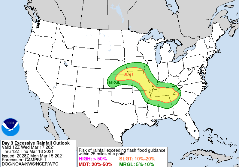
As we near closer, another low is expected to evolve and strengthen, bringing strong to severe storms to the Southeast. The latest from the SPC shows a MODERATE (4/5) region from Arkansas to Alabama Wednesday into Thursday. Parameters look very favorable for damaging winds, strong tornadoes, and heavy rain. The biggest threat across East Tennessee remains gusty winds, lightning, and heavy rain. In fact, the WPC has labeled the area under a slight risk (2/4) for flash flooding Wednesday to Thursday. A deep swath of moisture from the Gulf is expected to accompany the low, bringing heavy rain across the mid-Atlantic states. Rainfall amounts over the two-day period are expected (as of now) to range from 2-4 inches. This will depend on where the heaviest axes of rainfall sets up, so anticipate some changes and tweaks this afternoon as more data comes in. The overall set up is as follows: A strong low will build in from the west by Wednesday, bringing a warm front from the south. Heavy rains will accompany this front followed by a cold front to the west. Positioned between the two fronts is where severe weather will be the most likely. Fortunately for us, storms are expected to weaken with the eastward shift. Nightfall will also play a helpful roll in weakening storms as diurnal cooling begins to take place. This doesn't mean we still won't face severe weather, especially for Chattanooga and the Plateau, it just means the odds are a bit less given the timing. Following this intense storm complex, we'll begin clearing and drying out for the weekend. Sunshine is finally back in the forecast this weekend and early next week. With lots of active weather on the plate, be sure to check in for updates and changes. If you have family or friends in these southern states, pass along this information as this is a very serious outlook tomorrow into Thursday. This would also be a good opportunity to practice severe weather safety (regardless of the threat): do you have a safe spot if a tornado warning is issued? Do you have access to a NOAA weather radio? These are just a couple of the important safety tips that should be in place before severe weather strikes. Again, the biggest threat lies to the SW but weakening severe storms will be possible tomorrow evening. Pre-recorded for 5pm show
0 Comments
Leave a Reply. |
Your trusted source for everything weather in East Tennessee.
Social Media
|


