|
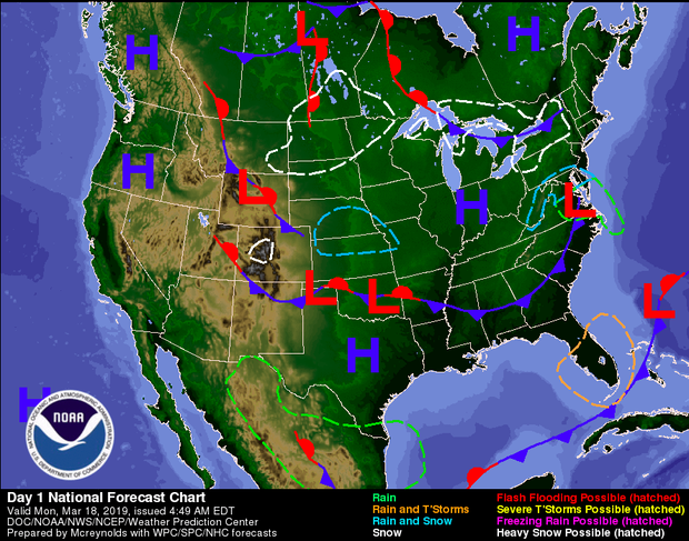
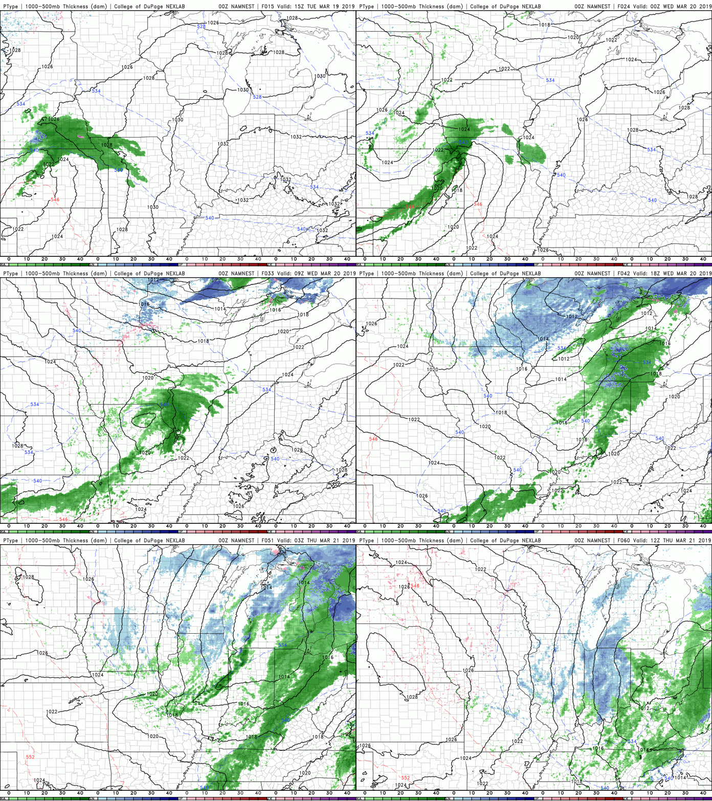
Due to the abundance of sun, there has been little to talk about weather wise. These clear conditions can be thanked in large part to the high pressure system that made its way into the Ohio Valley. It will stick around tomorrow, giving us sunny skies once more, before moving off of the coast. Behind this High is a Low, located to the north of North Dakota (in the graphic below). This low pressure system will move east bringing some tailing showers into our region. Most of these showers will occur late Wednesday night and into early Thursday morning. During the day Thursday, some scattered light showers are possible, but do not expect these to last very long. Below is the latest North American Model Mesoscale CONUS NEST run for the slight disturbance we will see Wednesday night into Thursday. After some minor rain showers, around a tenth of an inch total, expect sunny skies to return the rest of the week. For the rest of the week (Monday through the weekend) expect sunny skies and warming temperatures. We will see temperatures flirt with near 70 degrees by Sunday. Early next week rain showers will return, so enjoy this beautiful Spring (Starting March 20 @ 5:58 PM) weather while it lasts.
0 Comments
Leave a Reply. |
Your trusted source for everything weather in East Tennessee.
Social Media
|


